IMAGES TAKEN NEAR TO
Taylors Road, HITCHIN, SG5 4AZ
Introduction
This page details the photographs taken nearby to Taylors Road, SG5 4AZ by members of the Geograph project.
The Geograph project started in 2005 with the aim of publishing, organising and preserving representative images for every square kilometre of Great Britain, Ireland and the Isle of Man.

There are currently over 7.5m images from over14,400 individuals and you can help contribute to the project by visiting https://www.geograph.org.uk
Image Map
Images are licensed for reuse under creativecommons.org/licenses/by-sa/2.0
Notes
- Clicking on the map will re-center to the selected point.
- The higher the marker number, the further away the image location is from the centre of the postcode.
Image Listing (18 Images Found)
Images are licensed for reuse under creativecommons.org/licenses/by-sa/2.0
Image
Details
Distance

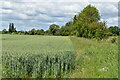
2
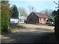
The River Ivel Nursery, Stotfold
I was curious as to what the cluster of little buildings on the 'Explorer' map is, and it turned out to be a plant nursery with greenhouses.
Image: © Humphrey Bolton
Taken: 21 Mar 2018
0.02 miles
7
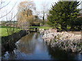
The River Ivel at Taylor's Road, Stotfold
Image: © Humphrey Bolton
Taken: 21 Mar 2018
0.12 miles
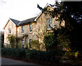
8
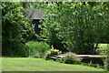
Gardens with a glimpse of Taylor's Mill on the River Ivel
Image: © David Martin
Taken: 29 May 2022
0.13 miles
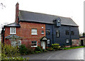
9
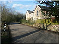
Ivel Mill, Stotfold
Not a mill building, and old maps do not show a mill here so it must have been demolished a long time ago.
Image: © Humphrey Bolton
Taken: 21 Mar 2018
0.13 miles
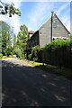
10

Gate on the footpath to Bowmans Mill
Image: © Philip Jeffrey
Taken: 7 Aug 2022
0.15 miles