IMAGES TAKEN NEAR TO
Bedford Road, HITCHIN, SG5 3RX
Introduction
This page details the photographs taken nearby to Bedford Road, SG5 3RX by members of the Geograph project.
The Geograph project started in 2005 with the aim of publishing, organising and preserving representative images for every square kilometre of Great Britain, Ireland and the Isle of Man.

There are currently over 7.5m images from over14,400 individuals and you can help contribute to the project by visiting https://www.geograph.org.uk
Image Map
Images are licensed for reuse under creativecommons.org/licenses/by-sa/2.0
Notes
- Clicking on the map will re-center to the selected point.
- The higher the marker number, the further away the image location is from the centre of the postcode.
Image Listing (6 Images Found)
Images are licensed for reuse under creativecommons.org/licenses/by-sa/2.0
Image
Details
Distance
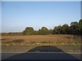
4
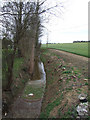
Field ditch/stream at Ramerick Bottom
Image: © Jeff Tomlinson
Taken: 2 Apr 2007
0.13 miles
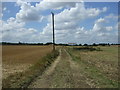
6
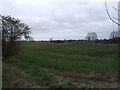
Field by Bedford Road, Holwellbury
This is the first field in Bedordshire having just crossed the brook behind the trees on the right.
Image: © David Howard
Taken: 15 Oct 2017
0.13 miles