IMAGES TAKEN NEAR TO
Pegsdon, HITCHIN, SG5 3LA
Introduction
This page details the photographs taken nearby to SG5 3LA by members of the Geograph project.
The Geograph project started in 2005 with the aim of publishing, organising and preserving representative images for every square kilometre of Great Britain, Ireland and the Isle of Man.

There are currently over 7.5m images from over14,400 individuals and you can help contribute to the project by visiting https://www.geograph.org.uk
Image Map (Loading...)


Getting Data...Please wait
Leaflet Map data © OpenStreetMap
Images are licensed for reuse under creativecommons.org/licenses/by-sa/2.0
Notes
- Clicking on the map will re-center to the selected point.
- The higher the marker number, the further away the image location is from the centre of the postcode.
Image Listing (8 Images Found)
Images are licensed for reuse under creativecommons.org/licenses/by-sa/2.0
Image
Details
Distance
1
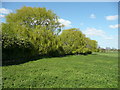
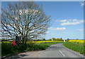
Willows near Green End Farm
Seen from the lane to the farm, and Bury Farm, which becomes the bridleway to Mill lane, Hexton
Image: © Humphrey Bolton
Taken: 15 Apr 2014
0.06 miles
2
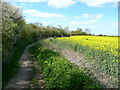
Bridleway, Pegsdon
This leads to Mill Lane, Hexton.
Image: © Humphrey Bolton
Taken: 15 Apr 2014
0.10 miles
3
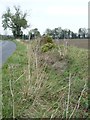
Overgrown ditch alongside the road to Apsley End
On the east verge.
Image: © Christine Johnstone
Taken: 30 Oct 2014
0.15 miles
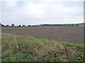
4

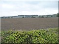
Farmland, Shillington
A footpath at the edge of a field of stubble to the north of Pegsdon.
Image: © Andrew Smith
Taken: 10 Oct 2010
0.16 miles
5
Greening field east of Green End Farm
On the east side of the road to Apsley End.
Image: © Christine Johnstone
Taken: 30 Oct 2014
0.18 miles
6
Letter box and telephone kiosk at Pegsdon
These are on the road to Shillington.
Image: © Humphrey Bolton
Taken: 15 Apr 2014
0.19 miles
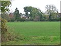
7
Farmland south-west of Pegsdon Common Farm
The farm is among the low-lying trees at the far side of the field.
Image: © Christine Johnstone
Taken: 30 Oct 2014
0.24 miles
8
Houses on Pegsdon Way, Pegsdon
Looking north-east from the road into Pegsdon from the B655.
Image: © Christine Johnstone
Taken: 30 Oct 2014
0.25 miles