IMAGES TAKEN NEAR TO
Sandy Heath Close, HITCHIN, SG5 3EF
Introduction
This page details the photographs taken nearby to Sandy Heath Close, SG5 3EF by members of the Geograph project.
The Geograph project started in 2005 with the aim of publishing, organising and preserving representative images for every square kilometre of Great Britain, Ireland and the Isle of Man.

There are currently over 7.5m images from over14,400 individuals and you can help contribute to the project by visiting https://www.geograph.org.uk
Image Map (Loading...)


Getting Data...Please wait
Leaflet Map data © OpenStreetMap
Images are licensed for reuse under creativecommons.org/licenses/by-sa/2.0
Notes
- Clicking on the map will re-center to the selected point.
- The higher the marker number, the further away the image location is from the centre of the postcode.
Image Listing (29 Images Found)
Images are licensed for reuse under creativecommons.org/licenses/by-sa/2.0
Image
Details
Distance
2
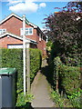
Footpath off Hanscombe End Road, Shillington
Image: © Humphrey Bolton
Taken: 12 Sep 2017
0.04 miles
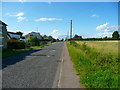
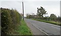
5
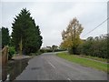
Hanscombe End Road, Apsley End
Looking north-west.
Image: © Christine Johnstone
Taken: 30 Oct 2014
0.13 miles
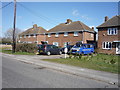
6
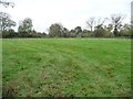
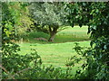
Paddock in the centre of Apsley End
On the east side of Hanscombe End Road.
Image: © Christine Johnstone
Taken: 30 Oct 2014
0.14 miles
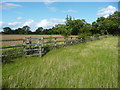
7
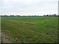
Farmland south-east of Hanscombe End
The distant houses are on the east side of Hanscombe End Road.
Image: © Christine Johnstone
Taken: 30 Oct 2014
0.14 miles
9
Part of a moated site, Shillington
This moat is shown on the map, but there isn't much to see. It is a scheduled ancient monument, and the 'Reasons for Designation' include:
"The moated site north of Apsley End is a well-preserved example of a small rectangular type with a moat ditch which retains waterlogged silts, from which environmental data may be recovered, and an island that contains evidence in the form of building remains. The monument lies in an area where smaller moated sites are particularly numerous and therefore chronological and social variations between sites may be explored."
Image: © Humphrey Bolton
Taken: 12 Sep 2017
0.16 miles
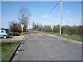
10
The road from Hanscombe End to Apsley End
Looking south-east along Hanscombe End Road.
Image: © Christine Johnstone
Taken: 30 Oct 2014
0.18 miles