
IMAGES TAKEN NEAR TO
Green Man Close, HITCHIN, SG5 3DW
Introduction
This page details the photographs taken nearby to Green Man Close, SG5 3DW by members of the Geograph project.
The Geograph project started in 2005 with the aim of publishing, organising and preserving representative images for every square kilometre of Great Britain, Ireland and the Isle of Man.

There are currently over 7.5m images from over14,400 individuals and you can help contribute to the project by visiting https://www.geograph.org.uk
Image Map
Images are licensed for reuse under creativecommons.org/licenses/by-sa/2.0
Notes
- Clicking on the map will re-center to the selected point.
- The higher the marker number, the further away the image location is from the centre of the postcode.
Image Listing (63 Images Found)
Images are licensed for reuse under creativecommons.org/licenses/by-sa/2.0
Image
Details
Distance
1
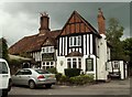
'The Old George' inn near Ickleford church
Image: © Robert Edwards
Taken: 8 Jun 2009
0.00 miles
2
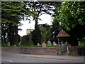
Ickleford Church
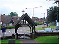
The church hides behind very tall trees, and has a small lych-gate with a pyramid roof.
Image: © Humphrey Bolton
Taken: Unknown
0.01 miles
5
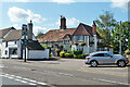
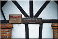
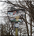
The Old George, Ickleford
A grade II listed building, 16th century or earlier in origin, with much later attention.
Image: © Robin Webster
Taken: 6 Sep 2015
0.01 miles
6
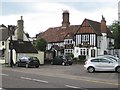
Ickleford: The Old George
The Old George is in fact a reversal of the modern trend of converting pubs into residences because at heart this is a 16th century hall house that was later converted into a public house. It is now a Grade II Listed Building and a Greene King outlet. Not sure which "old" George the pub is named after, except that it was one of the early Hanoverian mob.
Image: © Nigel Cox
Taken: 13 Jun 2010
0.02 miles
7
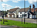
The Green Man (closed) and No. 39 Hair and Beauty, Ickleford
The pub was later demolished and replaced with houses.
Image: © Robin Webster
Taken: 6 Sep 2015
0.02 miles
8
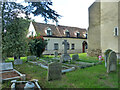
House on Church Path, Ickleford
A grade II listed building, late 17th century.
Image: © Robin Webster
Taken: 6 Sep 2015
0.03 miles
10
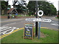
Ickleford: Pre-Worboys Report road sign
This is a rare survivor, in Hertfordshire at least, of a road direction sign pre-dating the 1964 Worboys Report with its wholesale changes to road signage. It is at a three-way road junction, and presumably at one time had a third arm pointing away down the road from the photographer in the direction of Letchworth and Baldock, that is no longer present.
The blackboard advertises food availability times at Image which is opposite.
The lych gate entrance to Image is visible to the left.
Image: © Nigel Cox
Taken: 13 Jun 2010
0.04 miles