
IMAGES TAKEN NEAR TO
Bearton Road, HITCHIN, SG5 1UB
Introduction
This page details the photographs taken nearby to Bearton Road, SG5 1UB by members of the Geograph project.
The Geograph project started in 2005 with the aim of publishing, organising and preserving representative images for every square kilometre of Great Britain, Ireland and the Isle of Man.

There are currently over 7.5m images from over14,400 individuals and you can help contribute to the project by visiting https://www.geograph.org.uk
Image Map
Images are licensed for reuse under creativecommons.org/licenses/by-sa/2.0
Notes
- Clicking on the map will re-center to the selected point.
- The higher the marker number, the further away the image location is from the centre of the postcode.
Image Listing (5 Images Found)
Images are licensed for reuse under creativecommons.org/licenses/by-sa/2.0
Image
Details
Distance
1
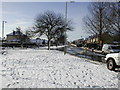
Old Hale Way
Looking south towards Bearton Road
Image: © Nick
Taken: 30 Jan 2003
0.19 miles
2

Footpath in Hitchin
This footpath connects Fishpond Road with Duke's Lane. It has some history and is shown on the 1898 1:2500 County Series map.
Image: © John Lucas
Taken: 19 Sep 2007
0.19 miles
3
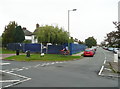
Building site, Strathmore Avenue, Hitchin
The site fencing is around a redevelopment to replace a house and some lock-up garages by two semi-detached houses.
Image: © Humphrey Bolton
Taken: 26 Sep 2017
0.23 miles
4
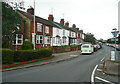
Periwinkle Lane, Hitchin
Not quite as rural as the name suggests.
Image: © Humphrey Bolton
Taken: 26 Sep 2017
0.23 miles
5
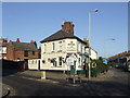
The Victoria, Hitchin
Staple Greene King hostelry
Image: © al partington
Taken: 15 Nov 2007
0.23 miles