
IMAGES TAKEN NEAR TO
Whinbush Road, HITCHIN, SG5 1PX
Introduction
This page details the photographs taken nearby to Whinbush Road, SG5 1PX by members of the Geograph project.
The Geograph project started in 2005 with the aim of publishing, organising and preserving representative images for every square kilometre of Great Britain, Ireland and the Isle of Man.

There are currently over 7.5m images from over14,400 individuals and you can help contribute to the project by visiting https://www.geograph.org.uk
Image Map
Images are licensed for reuse under creativecommons.org/licenses/by-sa/2.0
Notes
- Clicking on the map will re-center to the selected point.
- The higher the marker number, the further away the image location is from the centre of the postcode.
Image Listing (93 Images Found)
Images are licensed for reuse under creativecommons.org/licenses/by-sa/2.0
Image
Details
Distance
1
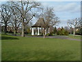
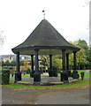
Bandstand in Bancroft Park
Self explanatory really. In the background is Bancroft Road.
Image: © Samir Jeraj
Taken: 22 Mar 2006
0.06 miles
2
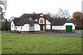
Pavilion-clubhouse, Bancroft Gardens
Built in 1929 according to this https://www.north-herts.gov.uk/sites/northherts-cms/files/5_bancroft_gardens_r1_conservation_plan-2.pdf.
Image: © Jim Osley
Taken: 11 Nov 2017
0.07 miles
3
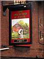
The Orchard & Anvil
Sign of the now closed pub.
Image: © John Lucas
Taken: 24 Sep 2008
0.10 miles
4
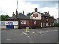
Hitchin: The former Orchard and Anvil public house
21 months on from OLU's Image and the building still survives.
This 1840s building was formerly The Woolpack and the yard behind was the location of a small forge, hence the modern re-branding. The 1884 Ordnance Survey map shows a substantial area of orchards on the opposite side of Nightingale Road facing the pub, between the present-day Grove Road and Florence Street, and this probably accounts for the other half of the name.
A planning application has been made to demolish the pub and replace it with a block of flats. However the Hitchin Historical Society have made an eloquent and well-thought out plea http://www.hitchinhistoricals.org.uk/news/feb_2009.php to keep the building because of its historic value and prominent location.
The information that the pub was formerly called the Woolpack warranted a search into old Census records yet curiously a brief search showed no mention of a pub with either name. Perhaps it was called something else before the Woolpack.
Image: © Nigel Cox
Taken: 13 Jun 2010
0.10 miles
6

Hitchin : Church of Our Lady Immaculate and St Andrew
History of the site at this https://taking-stock.org.uk/building/hitchin-our-lady-immaculate-and-st-andrew/
Image: © Jim Osley
Taken: 25 Jul 2026
0.12 miles
7
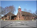
Church of Our Lady Immaculate and St Andrew Roman Catholic Church
Image: © JThomas
Taken: 25 Mar 2016
0.13 miles
8
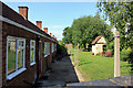
The rear aspect of the almshouses, Hitchin
The 1699 front onto Banroft has been preserved (seeImage), but the rear has seen the addition of a modern extension. Washing lines are still in place.
Image: © Peter Church
Taken: 15 Jun 2009
0.13 miles
9
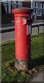
Elizabeth II postbox on Walsworth Road, Hitchin
Postbox No. SG4 51.
See Image] for cypher.
See Image] for detail.
See Image] and Image] for context.
Image: © JThomas
Taken: 25 Mar 2016
0.14 miles
10
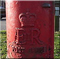
Cypher, Elizabeth II postbox on Walsworth Road, Hitchin
Postbox No. SG4 51.
See Image] for postbox.
Image: © JThomas
Taken: 25 Mar 2016
0.14 miles