IMAGES TAKEN NEAR TO
Grange Close, HITCHIN, SG4 9HD
Introduction
This page details the photographs taken nearby to Grange Close, SG4 9HD by members of the Geograph project.
The Geograph project started in 2005 with the aim of publishing, organising and preserving representative images for every square kilometre of Great Britain, Ireland and the Isle of Man.

There are currently over 7.5m images from over14,400 individuals and you can help contribute to the project by visiting https://www.geograph.org.uk
Image Map
Images are licensed for reuse under creativecommons.org/licenses/by-sa/2.0
Notes
- Clicking on the map will re-center to the selected point.
- The higher the marker number, the further away the image location is from the centre of the postcode.
Image Listing (11 Images Found)
Images are licensed for reuse under creativecommons.org/licenses/by-sa/2.0
Image
Details
Distance
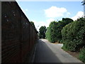
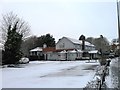
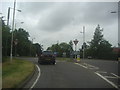
2
London Road, Gosmore
Just entering the urban area of Hitchin
Image: © David Howard
Taken: 15 Oct 2017
0.10 miles
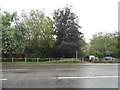
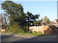
3
Newlands Lane
Looking south east from London Road.
Image: © JThomas
Taken: 15 Aug 2015
0.14 miles
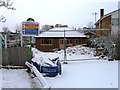
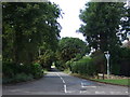
6

Roundabout on London Road, Gosmore
At the junction of Broadmeadow Rise
Image: © David Howard
Taken: 16 Jan 2022
0.14 miles