
IMAGES TAKEN NEAR TO
Woolgrove Road, HITCHIN, SG4 0AU
Introduction
This page details the photographs taken nearby to Woolgrove Road, SG4 0AU by members of the Geograph project.
The Geograph project started in 2005 with the aim of publishing, organising and preserving representative images for every square kilometre of Great Britain, Ireland and the Isle of Man.

There are currently over 7.5m images from over14,400 individuals and you can help contribute to the project by visiting https://www.geograph.org.uk
Image Map
Images are licensed for reuse under creativecommons.org/licenses/by-sa/2.0
Notes
- Clicking on the map will re-center to the selected point.
- The higher the marker number, the further away the image location is from the centre of the postcode.
Image Listing (35 Images Found)
Images are licensed for reuse under creativecommons.org/licenses/by-sa/2.0
Image
Details
Distance
1
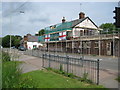
Walsworth: The Sailor
Building renovation works give the opportunity to fly the flag (or two in this case). Why the Sailor? Well, I read somewhere that at one time the River Ivel Navigation was to be extended to include the Rivers Hiz and Purwell, the latter of which is on the opposite side of the road to the pub.
Image: © Nigel Cox
Taken: 13 Jun 2010
0.00 miles
2
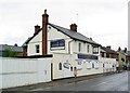
"The Sailor Boy" public house, Hitchin
Closed 2013.
Image: © Jim Osley
Taken: 2 Nov 2014
0.01 miles
3
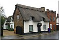
Grade II listed cottage, Woolcroft Road, Hitchin
Description at this http://list.english-heritage.org.uk/resultsingle.aspx?uid=1347608.
Image: © Jim Osley
Taken: 2 Nov 2014
0.02 miles
4

River Purwell at Walsworth Common
The Purwell is a tributary of the River Hiz and this is the point at which the footbridge linking Woolgrove Road and Walsworth Common crosses it.
Image: © Nigel Cox
Taken: 13 Jun 2010
0.02 miles
5
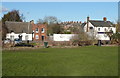
Houses and closed pub, Woolgrove Road
The thatched cottage and red-brick house are listed, Grade II. They are timber-framed and were built in the 17C or possibly earlier, and the brick front was added later.
Image: © Humphrey Bolton
Taken: 17 Feb 2015
0.03 miles
6
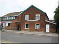
Walsworth Community Centre
This building on Woolgrove Road was once the Walsworth School founded by the Quaker Mary Exton in 1852. The nearby Mary Exton Junior Mixed Infants School was named in her honour.
Image: © Nigel Cox
Taken: 13 Jun 2010
0.04 miles
7
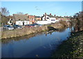
The River Purwell, Walsworth
The thatched cottage and red-brick house are listed, Grade II. They are timber-framed and were built in the 17C or possibly earlier, and the brick front was added later.
Image: © Humphrey Bolton
Taken: 17 Feb 2015
0.05 miles
8
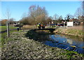
Bridge over the River Purwell
This bridge appears to be for maintenance of the Walsworth Common playing fields, and is used at present for plant working on the construction of a children's playground. Th driver is waiting for a colleague to come and unlock the barrier.
Image: © Humphrey Bolton
Taken: 17 Feb 2015
0.09 miles
10
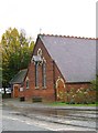
St Faith's Church, Hitchin
Joint Church of England & Methodist.
Image: © Jim Osley
Taken: 2 Nov 2014
0.12 miles