IMAGES TAKEN NEAR TO
SG19 3HS
Introduction
This page details the photographs taken nearby to SG19 3HS by members of the Geograph project.
The Geograph project started in 2005 with the aim of publishing, organising and preserving representative images for every square kilometre of Great Britain, Ireland and the Isle of Man.

There are currently over 7.5m images from over14,400 individuals and you can help contribute to the project by visiting https://www.geograph.org.uk
Image Map
Images are licensed for reuse under creativecommons.org/licenses/by-sa/2.0
Notes
- Clicking on the map will re-center to the selected point.
- The higher the marker number, the further away the image location is from the centre of the postcode.
Image Listing (14 Images Found)
Images are licensed for reuse under creativecommons.org/licenses/by-sa/2.0
Image
Details
Distance
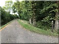
1
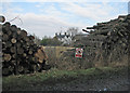
Hatley St George: timber stacks by Buff Lane
Home Farm in the background.
Image: © John Sutton
Taken: 14 Feb 2017
0.01 miles
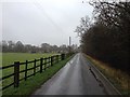
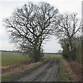
3
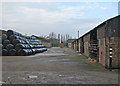
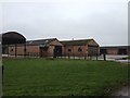
Hatley St George: Home Farm yard
A February view from Buff Lane. The beasts were inside.
Image: © John Sutton
Taken: 14 Feb 2017
0.05 miles
6
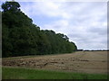
Buff Wood SSSI
A long-standing woodland listed as a representative of wet ash-maple and pedunculate oak-hazel/ash woodland, with typical ancient woodland plants. http://www.english-nature.org.uk/citation/citation_photo/1000205.pdf
Image: © Keith Edkins
Taken: 30 Aug 2007
0.18 miles
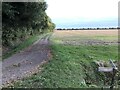
9
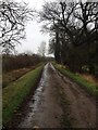
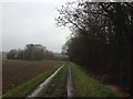
Hatley St George: Buff Lane and winter trees
Buff Lane continues as a farm track to Pincote Barn.
Image: © John Sutton
Taken: 14 Feb 2017
0.20 miles