IMAGES TAKEN NEAR TO
Victoria Close, SANDY, SG19 2UA
Introduction
This page details the photographs taken nearby to Victoria Close, SG19 2UA by members of the Geograph project.
The Geograph project started in 2005 with the aim of publishing, organising and preserving representative images for every square kilometre of Great Britain, Ireland and the Isle of Man.

There are currently over 7.5m images from over14,400 individuals and you can help contribute to the project by visiting https://www.geograph.org.uk
Image Map
Images are licensed for reuse under creativecommons.org/licenses/by-sa/2.0
Notes
- Clicking on the map will re-center to the selected point.
- The higher the marker number, the further away the image location is from the centre of the postcode.
Image Listing (24 Images Found)
Images are licensed for reuse under creativecommons.org/licenses/by-sa/2.0
Image
Details
Distance
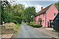
1
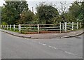
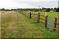
The corner of Alexander Road, Wrestlingworth
A little brook runs along the main road behind the railings.
Image: © David Howard
Taken: 24 Oct 2021
0.02 miles
5
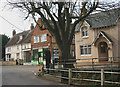
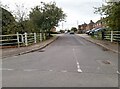
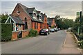
Wrestlingworth, centre of village
Taken at the junction of High Street (left) and Butchers Lane (right).
Image: © David Kemp
Taken: 8 Mar 2014
0.15 miles