IMAGES TAKEN NEAR TO
Bunyan Road, SANDY, SG19 1BJ
Introduction
This page details the photographs taken nearby to Bunyan Road, SG19 1BJ by members of the Geograph project.
The Geograph project started in 2005 with the aim of publishing, organising and preserving representative images for every square kilometre of Great Britain, Ireland and the Isle of Man.

There are currently over 7.5m images from over14,400 individuals and you can help contribute to the project by visiting https://www.geograph.org.uk
Image Map
Images are licensed for reuse under creativecommons.org/licenses/by-sa/2.0
Notes
- Clicking on the map will re-center to the selected point.
- The higher the marker number, the further away the image location is from the centre of the postcode.
Image Listing (10 Images Found)
Images are licensed for reuse under creativecommons.org/licenses/by-sa/2.0
Image
Details
Distance
1
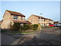
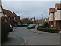
Havelock Close
1980s houses in Sandy.
Image: © Burgess Von Thunen
Taken: 20 Jan 2014
0.12 miles
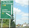
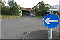
3
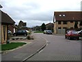
Varsity Line
The Varsity Line connected Oxford and Cambridge and train services ran on the section between Bedford and Cambridge until the end of 1967 https://en.wikipedia.org/wiki/Varsity_Line . Plans are underway to reopen the line in stages between Oxford and Cambridge, and the route is now known as East West Rail.
Some local authorities have taken steps to protect disused rail routes. Hence much of the original alignment between Oxford and Bedford will be/is being reused as it was because it was not built over in the meantime. However, there are several places between Bedford and Cambridge where the old route has been built over, and consequently a completely fresh route is likely to be constructed for this section.
The road in the foreground follows the alignment of the Varsity Line with Sandy Village Hall being situated to the right of the photo. In the distance can be seen Sandy Secondary School, which features turquoise coloured window frames. The Varsity Line would have passed through what are now the grounds of the school and would have been extremely close to the south west corner of the school building. A chord also took trains from Bedford to join the northbound East Coast Main Line. Details of the Sandy Stations and an old one inch Ordnance Survey map of the area may be found here http://www.disused-stations.org.uk/s/sandy/index.shtml
More details of future plans for East West Rail are available from https://www.eastwestrail.org.uk/central-section-overview/
Image: © Andrew Bodman
Taken: 10 Sep 2018
0.18 miles
7
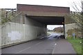
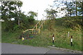
A1 underpass
Until 1967, this bridge carried the A1 over the Sandy to Bedford railway line, and Girtford Halt (http://www.disused-stations.org.uk/g/girtford_halt/index.shtml ) stood roughly where this picture was taken from. Now, the railway has been replaced by a minor road connecting two halves of a junction on the A1.
Image: © Ben Harris
Taken: 18 Feb 2012
0.21 miles
9
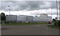
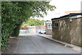
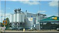
Industrial building
The A1 runs to the left of the building.
Image: © Andrew Tatlow
Taken: 26 May 2006
0.24 miles