
IMAGES TAKEN NEAR TO
Langford Road, BIGGLESWADE, SG18 9RA
Introduction
This page details the photographs taken nearby to Langford Road, SG18 9RA by members of the Geograph project.
The Geograph project started in 2005 with the aim of publishing, organising and preserving representative images for every square kilometre of Great Britain, Ireland and the Isle of Man.

There are currently over 7.5m images from over14,400 individuals and you can help contribute to the project by visiting https://www.geograph.org.uk
Image Map
Images are licensed for reuse under creativecommons.org/licenses/by-sa/2.0
Notes
- Clicking on the map will re-center to the selected point.
- The higher the marker number, the further away the image location is from the centre of the postcode.
Image Listing (9 Images Found)
Images are licensed for reuse under creativecommons.org/licenses/by-sa/2.0
Image
Details
Distance
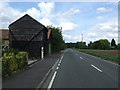
3

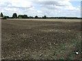
Field of rye next to Sheep Walk
Sheep Walk is a track off Langford Road which leads to Holmegreen Level Crossing. The gates at the crossing are hand operated by the user and a green light indicates it is safe to cross quickly over the East Coast Main Line. There are also separate pedestrian gates - see http://www.geograph.org.uk/photo/5441343 Beyond is a network of footpaths to the south of Biggleswade and west of the A1.
The wind turbines in the photograph are on the other side of the East Coast Main Line. This view is next to the junction with Langford Road.
Image: © Marathon
Taken: 24 Jun 2017
0.14 miles
4

Sheep Walk
Sheep Walk is a track off Langford Road which leads to Holmegreen Level Crossing. The gates at the crossing are hand operated by the user and a green light indicates it is safe to cross quickly over the East Coast Main Line. There are also separate pedestrian gates - see http://www.geograph.org.uk/photo/5441343 Beyond is a network of footpaths to the south of Biggleswade and west of the A1.
Image: © Marathon
Taken: 24 Jun 2017
0.16 miles
5
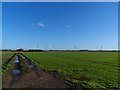
Footpath towards Holme Green
Wind turbines in the background are not yet marked on the O.S. map.
Image: © Bikeboy
Taken: 2 Jan 2014
0.16 miles
6
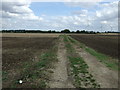
Farm track (Footpath) off Langford Road
Looking east.
Image: © JThomas
Taken: 15 Aug 2015
0.16 miles
7

Holme: Yay, sprouts!
Christmas is a-coming and with it the seasonal battle of wills between parents and children about just how many sprouts they, the children that is, must eat... Good news for kids though is that sprouts are likely to be victims of the wet summer of 2007. The harvest is forecast to be down by between 15 and 20%, and they are reputedly likely to be both expensive and in short supply this winter. These massed ranks of the beasties are viewed from the road to Holme Mills with the buildings of Scroup's Farm on the horizon.
Image: © Nigel Cox
Taken: 11 Nov 2007
0.18 miles
8
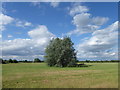
View from Sheep Walk
Sheep Walk is a track off Langford Road which leads to Holmegreen Level Crossing. The gates at the crossing are hand operated by the user and a green light indicates it is safe to cross quickly over the East Coast Main Line. There are also separate pedestrian gates - see http://www.geograph.org.uk/photo/5441343 Beyond is a network of footpaths to the south of Biggleswade and west of the A1.
Image: © Marathon
Taken: 24 Jun 2017
0.18 miles
9
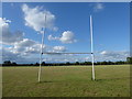
Rugby pitch next to Sheep Walk
Sheep Walk is a track off Langford Road which leads to Holmegreen Level Crossing. The gates at the crossing are hand operated by the user and a green light indicates it is safe to cross quickly over the East Coast Main Line. There are also separate pedestrian gates - see http://www.geograph.org.uk/photo/5441343 Beyond is a network of footpaths to the south of Biggleswade and west of the A1.
These rugby pitches lie to the north of Sheep Walk.
Image: © Marathon
Taken: 24 Jun 2017
0.23 miles