
IMAGES TAKEN NEAR TO
Kitelands Road, BIGGLESWADE, SG18 8NS
Introduction
This page details the photographs taken nearby to Kitelands Road, SG18 8NS by members of the Geograph project.
The Geograph project started in 2005 with the aim of publishing, organising and preserving representative images for every square kilometre of Great Britain, Ireland and the Isle of Man.

There are currently over 7.5m images from over14,400 individuals and you can help contribute to the project by visiting https://www.geograph.org.uk
Image Map
Images are licensed for reuse under creativecommons.org/licenses/by-sa/2.0
Notes
- Clicking on the map will re-center to the selected point.
- The higher the marker number, the further away the image location is from the centre of the postcode.
Image Listing (17 Images Found)
Images are licensed for reuse under creativecommons.org/licenses/by-sa/2.0
Image
Details
Distance
3
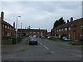
Service road parallel to London Road, Biggleswade
Seen from Kitelands Road, which provides the only vehicular access.
Image: © Richard Vince
Taken: 10 Oct 2020
0.05 miles
4

Path off London Road, Biggleswade
A combined footpath and cycle path leading to Foxglove Drive, seen from the very conveniently positioned toucan crossing on London Road.
Image: © Richard Vince
Taken: 10 Oct 2020
0.07 miles
5
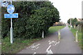
Footpath to Saxon Pool and Leisure Centre
Image: © Philip Jeffrey
Taken: 16 Mar 2016
0.07 miles
6
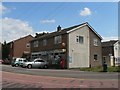
Biggleswade: Kitelands stores and post office
The post office is one of 2,500 in the UK to close in 2008. Not only the post office counter but the entire shop is only open till lunchtime, and I doubt it will survive for long when the post office finishes.
Image: © Chris Downer
Taken: 15 Jul 2008
0.10 miles
7
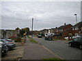
South western section of Kitelands Road, Biggleswade
Image: © Richard Vince
Taken: 10 Oct 2020
0.13 miles
8
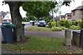
To London 44 Miles
Old milestone on what was the Great North Road (A1) before being bypassed at Biggleswade, Bedfordshire. For close up view see http://www.geograph.org.uk/photo/5525809
Image: © Keith Evans
Taken: 29 Jun 2017
0.16 miles
10
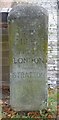
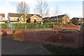
Old Milestone by the A6001, London Road, Biggleswade
Carved stone post by the A6001 (was A1), in parish of BIGGLESWADE (MID BEDFORDSHIRE District), London Road, set back from road, on West side of road, nearly opposite Chambers Way. Erected by the Biggleswade to Alconbury Hill turnpike trust in the 19th century.
Inscription reads:-
44
MILES
FROM
LONDON
STRATTON
Milestone Society National ID: BD_LY44
Image: © M Knight
Taken: 1 Nov 2002
0.17 miles