IMAGES TAKEN NEAR TO
Apple Tree Close, BIGGLESWADE, SG18 8NF
Introduction
This page details the photographs taken nearby to Apple Tree Close, SG18 8NF by members of the Geograph project.
The Geograph project started in 2005 with the aim of publishing, organising and preserving representative images for every square kilometre of Great Britain, Ireland and the Isle of Man.

There are currently over 7.5m images from over14,400 individuals and you can help contribute to the project by visiting https://www.geograph.org.uk
Image Map
Images are licensed for reuse under creativecommons.org/licenses/by-sa/2.0
Notes
- Clicking on the map will re-center to the selected point.
- The higher the marker number, the further away the image location is from the centre of the postcode.
Image Listing (11 Images Found)
Images are licensed for reuse under creativecommons.org/licenses/by-sa/2.0
Image
Details
Distance
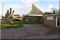
1
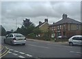
London Road at the junction of Grove Road
Image: © David Howard
Taken: 31 May 2012
0.06 miles
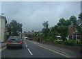
2
London Road at the junction of Grove Road
Image: © David Howard
Taken: 31 May 2012
0.06 miles
5

The Old Orchard, Biggleswade
A private road off Eagle Farm Road.
Image: © Richard Vince
Taken: 10 Oct 2020
0.13 miles
6

Lane off Eagle Farm Road, Biggleswade
Also hosting a public footpath.
Image: © Richard Vince
Taken: 10 Oct 2020
0.14 miles
8
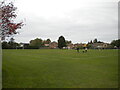
Playing fields off Eagle Farm Road, Biggleswade
A public footpath crosses the playing fields in the direction of this view; however, I skirted the edges of the football pitches on this occasion to avoid a ball in the face.
Image: © Richard Vince
Taken: 10 Oct 2020
0.20 miles
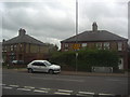
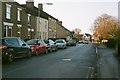
9
Biggleswade: Drove Road
The tablets in the walls of these terraced houses read
B.U.D.C.
1913
B.U.D.C. stands for Biggleswade Urban District Council who were the main authority in the town prior to the reorganization of local government in 1973. Drove Road is also the B1040 to Potton and, eventually, St Ives.
Image: © Nigel Cox
Taken: 11 Nov 2007
0.23 miles
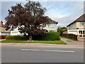
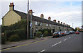
10
The Baulk, Biggleswade
Residential street in Biggleswade, Bedfordshire, formerly the home of some friends of mine.
Image: © John Winder
Taken: 30 Nov 2014
0.24 miles