
IMAGES TAKEN NEAR TO
Lincoln Crescent, BIGGLESWADE, SG18 8HR
Introduction
This page details the photographs taken nearby to Lincoln Crescent, SG18 8HR by members of the Geograph project.
The Geograph project started in 2005 with the aim of publishing, organising and preserving representative images for every square kilometre of Great Britain, Ireland and the Isle of Man.

There are currently over 7.5m images from over14,400 individuals and you can help contribute to the project by visiting https://www.geograph.org.uk
Image Map
Images are licensed for reuse under creativecommons.org/licenses/by-sa/2.0
Notes
- Clicking on the map will re-center to the selected point.
- The higher the marker number, the further away the image location is from the centre of the postcode.
Image Listing (12 Images Found)
Images are licensed for reuse under creativecommons.org/licenses/by-sa/2.0
Image
Details
Distance
2
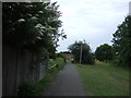
Cycle path heading south near the railway, Biggleswade
Image: © JThomas
Taken: 15 Aug 2012
0.05 miles
3
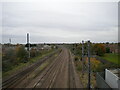
East Coast Main Line, Biggleswade
Looking towards Peterborough, northern England, and Scotland from a footbridge near the southern edge of the town. The twin island platforms of Biggleswade station can just be glimpsed as the railway bends to the left.
Image: © Richard Vince
Taken: 10 Oct 2020
0.07 miles
4
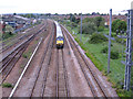
Express train south of Biggleswade station, Beds
– view N from the Grasmere Road footbridge.
Image: © Rodney Burton
Taken: 19 May 2006
0.07 miles
5
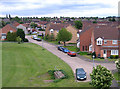
Grasmere Road, Biggleswade, Beds
– view E from the railway footbridge.
Image: © Rodney Burton
Taken: 19 May 2006
0.07 miles
6
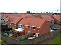
Roofscape, south Biggleswade, Beds
– new housing off Hitchin Street; view down from the Grasmere Road railway footbridge.
Image: © Rodney Burton
Taken: 19 May 2006
0.10 miles
7
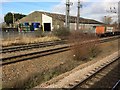
View from a Peterborough-London train - goods shed at Biggleswade
Image: © Nigel Thompson
Taken: 7 Feb 2017
0.13 miles
9
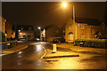
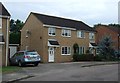
Brunel Drive
A recent housing development at the south end of Biggleswade. Not sure of the connection to Brunel - Perhaps Ivatt or Gresley would have been better choices as engineers associated with the nearby east coast mainline?
Image: © Martin Addison
Taken: 17 Sep 2013
0.19 miles
10
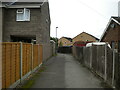
Public footpath off Holme Court Avenue, Biggleswade
Leading to Derwent Avenue.
Image: © Richard Vince
Taken: 10 Oct 2020
0.21 miles