IMAGES TAKEN NEAR TO
Heron Close, BIGGLESWADE, SG18 8HG
Introduction
This page details the photographs taken nearby to Heron Close, SG18 8HG by members of the Geograph project.
The Geograph project started in 2005 with the aim of publishing, organising and preserving representative images for every square kilometre of Great Britain, Ireland and the Isle of Man.

There are currently over 7.5m images from over14,400 individuals and you can help contribute to the project by visiting https://www.geograph.org.uk
Image Map
Images are licensed for reuse under creativecommons.org/licenses/by-sa/2.0
Notes
- Clicking on the map will re-center to the selected point.
- The higher the marker number, the further away the image location is from the centre of the postcode.
Image Listing (14 Images Found)
Images are licensed for reuse under creativecommons.org/licenses/by-sa/2.0
Image
Details
Distance
1
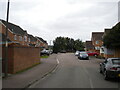
Kayser Court, Biggleswade
Off Hitchin Street.
Image: © Richard Vince
Taken: 10 Oct 2020
0.10 miles
2
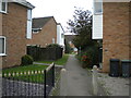
Footpath off Hitchin Street, Biggleswade
Leading to the end of Osprey Road.
Image: © Richard Vince
Taken: 10 Oct 2020
0.10 miles
3
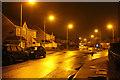
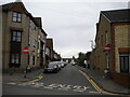
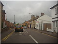
Hitchin Street
At the junction with Kayser Court and Windmill View.
Image: © Martin Addison
Taken: 17 Sep 2013
0.11 miles
4
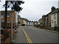
Hitchin Street, Biggleswade
Looking towards the town centre from the junction with South View.
Image: © Richard Vince
Taken: 10 Oct 2020
0.11 miles
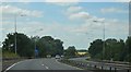
5
Blunham Road, Biggleswade
Off Hitchin Street.
Image: © Richard Vince
Taken: 10 Oct 2020
0.15 miles
6
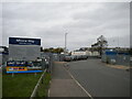
Albone Way Industrial Estate, Biggleswade
Off Hitchin Street at the south western corner of the town.
Image: © Richard Vince
Taken: 10 Oct 2020
0.15 miles
8
Brunel Drive
A recent housing development at the south end of Biggleswade. Not sure of the connection to Brunel - Perhaps Ivatt or Gresley would have been better choices as engineers associated with the nearby east coast mainline?
Image: © Martin Addison
Taken: 17 Sep 2013
0.19 miles
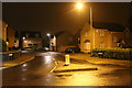
9
Hitchin Street at the junction of Teal Road
Image: © David Howard
Taken: 31 May 2012
0.19 miles
10
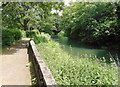
Path by the Ivel
The River Ivel was navigable years ago and quite a few stretches of what was once presumably the tow path are now pleasant riverside public footpaths.
Image: © Des Blenkinsopp
Taken: 14 Jun 2018
0.22 miles