
IMAGES TAKEN NEAR TO
Stratton Way, BIGGLESWADE, SG18 0NW
Introduction
This page details the photographs taken nearby to Stratton Way, SG18 0NW by members of the Geograph project.
The Geograph project started in 2005 with the aim of publishing, organising and preserving representative images for every square kilometre of Great Britain, Ireland and the Isle of Man.

There are currently over 7.5m images from over14,400 individuals and you can help contribute to the project by visiting https://www.geograph.org.uk
Image Map
Images are licensed for reuse under creativecommons.org/licenses/by-sa/2.0
Notes
- Clicking on the map will re-center to the selected point.
- The higher the marker number, the further away the image location is from the centre of the postcode.
Image Listing (9 Images Found)
Images are licensed for reuse under creativecommons.org/licenses/by-sa/2.0
Image
Details
Distance
1
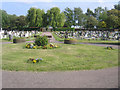
Biggleswade Town Cemetery, Beds
off Stratton Way, an overflow cemetery for the one in Drove Road. Image
Image: © Rodney Burton
Taken: 2 Jun 2006
0.12 miles
2
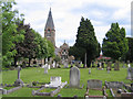
Biggleswade Cemetery, Beds
on Drove Road.
Image: © Rodney Burton
Taken: 25 May 2006
0.19 miles
3
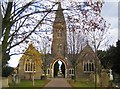
Biggleswade: Cemetery mortuary chapels
These two chapels are joined by an arch and spire and are in the centre of Biggleswade Cemetery. Rowan Crescent is visible in the far distance through the arch.
Image: © Nigel Cox
Taken: 11 Nov 2007
0.21 miles
4
Drove Road, Biggleswade
It was not an official road block but the same effect for a few moments.
Image: © David Howard
Taken: 31 May 2012
0.24 miles
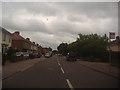
6

Old Milepost
Old milepost on the B1040 at Biggleswade, Bedfordshire. For close up view see http://www.geograph.org.uk/photo/5525437
Image: © Keith Evans
Taken: 29 Jun 2017
0.24 miles
7
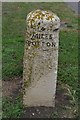
To St. Ives 18
Old milepost on the B1040 at Biggleswade, Bedfordshire. For overall view see http://www.geograph.org.uk/photo/5525432
Image: © Keith Evans
Taken: 29 Jun 2017
0.24 miles
8
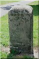
Old Milestone by the B1040, Potton Road, Biggleswade
Carved stone post by the B1040, in parish of BIGGLESWADE (MID BEDFORDSHIRE District), Potton Road, near school, on grass verge, within pavement verge, on East side of road. Just north east of Drove Road junction. Potton stone, erected by the Shelton Lane, Bury & Stratton turnpike trust in the 19th century.
Inscription reads:-
: BIGGLESWADE / 1 / MILE : : POTTON 3 MILES :
Milestone Society National ID: BD_BWPO01
Image: © M Knight
Taken: 1 Jul 2002
0.25 miles
9
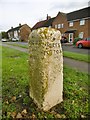
Old Milestone by the B1040, Potton Road, Biggleswade
Carved stone post by the B1040, in parish of Biggleswade (Mid Bedfordshire District), Potton Road, in front of service road, on grass verge, on South-East side of road. Potton stone, erected by the Shelton Lane, Bury & Stratton Turnpike Trust in the 19th century.
Inscription reads:-
: BIGGLESWADE / 1 / MILE : : LONDON / 45 / MILES : : 4 / MILES / POTTON :
(The distance to Potton should read 3 miles.)
OS rivet hole on top.
Milestone Society National ID: BD_BWPO01.
Image: © Milestone Society
Taken: 27 Nov 2017
0.25 miles