IMAGES TAKEN NEAR TO
Heronslee, SHEFFORD, SG17 5FQ
Introduction
This page details the photographs taken nearby to Heronslee, SG17 5FQ by members of the Geograph project.
The Geograph project started in 2005 with the aim of publishing, organising and preserving representative images for every square kilometre of Great Britain, Ireland and the Isle of Man.

There are currently over 7.5m images from over14,400 individuals and you can help contribute to the project by visiting https://www.geograph.org.uk
Image Map
Images are licensed for reuse under creativecommons.org/licenses/by-sa/2.0
Notes
- Clicking on the map will re-center to the selected point.
- The higher the marker number, the further away the image location is from the centre of the postcode.
Image Listing (64 Images Found)
Images are licensed for reuse under creativecommons.org/licenses/by-sa/2.0
Image
Details
Distance
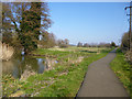
1
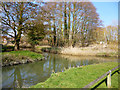
Waterway junction, Shefford
The Rivers Flit and Hit come together. They were used up to the 1870s for the two terminal branches of the Ivel Navigation to North Bridge (far, Flit) and South Bridge (near, Hit).
Image: © Robin Webster
Taken: 13 Mar 2016
0.06 miles
2
Bus stop and shelter on Clifton Road, Shefford
Image: © JThomas
Taken: 22 Aug 2015
0.07 miles
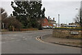
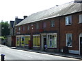
3
Industrial site on Clifton Road, Shefford
Image: © David Howard
Taken: 6 Sep 2020
0.08 miles
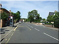
4
Hitchin Road at the corner of Ivel Road
Image: © David Howard
Taken: 30 Jan 2022
0.08 miles
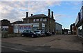
5
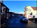
Clifton Road and the White Hart Hotel, Shefford
The low midwinter sun rendering one half of the street in bright sunlight, the other in shadow.
Image: © Bikeboy
Taken: 22 Dec 2013
0.08 miles
6
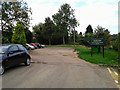
Parking area at the back of The White Hart, Shefford
Image: © Rob Purvis
Taken: 28 Sep 2013
0.09 miles
7
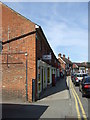
Shefford Post Office
On South Bridge Street.
Image: © JThomas
Taken: 22 Aug 2015
0.09 miles
8
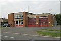
Shefford fire station
Shefford fire station, Ivel Road, Shefford, Bedfordshire
Image: © Kevin Hale
Taken: 7 Oct 2007
0.10 miles
9
Shefford Post Office
On South Bridge Street.
Image: © JThomas
Taken: 22 Aug 2015
0.10 miles
10
Former course of Ivel Navigation, Shefford
The natural course of the River Flit bends round to the left via a former mill, The navigation lock cut went straight on here, to the left of the now tarmac towpath. The lock was at the far end just before rejoining the river. There is now no trace of cut or lock which have been filled in or apparently dismantled.
Image: © Robin Webster
Taken: 13 Mar 2016
0.10 miles