
IMAGES TAKEN NEAR TO
Chase Hill Road, ARLESEY, SG15 6UE
Introduction
This page details the photographs taken nearby to Chase Hill Road, SG15 6UE by members of the Geograph project.
The Geograph project started in 2005 with the aim of publishing, organising and preserving representative images for every square kilometre of Great Britain, Ireland and the Isle of Man.

There are currently over 7.5m images from over14,400 individuals and you can help contribute to the project by visiting https://www.geograph.org.uk
Image Map
Images are licensed for reuse under creativecommons.org/licenses/by-sa/2.0
Notes
- Clicking on the map will re-center to the selected point.
- The higher the marker number, the further away the image location is from the centre of the postcode.
Image Listing (16 Images Found)
Images are licensed for reuse under creativecommons.org/licenses/by-sa/2.0
Image
Details
Distance
1
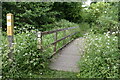
Footbridge between the railway and the River Hiz
On a permissive path, forming part of the Hicca Way.
Image: © David Martin
Taken: 29 May 2022
0.09 miles
2
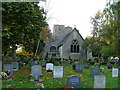
Parish Church of St Peter - Church End Arlesey
Tucked away at the end of Arlesey (which according to local legend, is the longest village in the UK). This claim can be checked using Google if you like - it seems not to be true. The church is a bit run down and has some old wooden crosses in the graveyard.
Image: © Robin Hall
Taken: 30 Oct 2005
0.13 miles
3
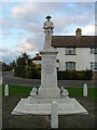
Arlesey war memorial.
This war memorial depicting a first world war soldier is already beginning to deteriorate. The soldier's face is beginning to erode.
Image: © Robin Hall
Taken: 30 Oct 2005
0.13 miles
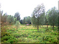
5

Work is underway on Arlesey relief road
Initial groundwork on a road link that will connect the High Street with the A507, accompanied by extensive additional residential development.
Image: © David Martin
Taken: 13 Nov 2022
0.17 miles
6

Groundwork for Arlesey Relief Road
Initial groundwork on a road link that will connect the High Street with the A507, accompanied by extensive additional residential development.
Image: © David Martin
Taken: 13 Nov 2022
0.19 miles
7

Looking north from the foot crossing at Arlesey
Standing on the down fast line of the East Coast Main Line with the knowledge that 125 mph trains might be coming up behind, it was useful to have someone keeping watch when taking this photograph. The down slow line is on the left and the up fast and up slow on the right. Some foot crossings on the ECML have red or green lights to indicate when a train is coming or when it is clear. Not this one though - only good eyesight indicates when it is safe to cross!
Image: © Kenneth Yarham
Taken: 10 Apr 2009
0.19 miles
9
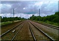
Pedestrian Level Crossing
I didn't know that many of these still existed. And no isolated back-water on a heritage steam railway, this. Every few minutes a GNER train hoots from a mile away and thunders through at 200 km/h.
Judging by the amount of dog mess and beer cans the footpath is well trafficked too.
Image: © Dominic Cropper
Taken: 22 Jun 2007
0.20 miles
10

Sign of the times
Sign at the former dairy
Image: © Malcolm Campbell
Taken: 4 Mar 2002
0.21 miles