
IMAGES TAKEN NEAR TO
Bury Mead, ARLESEY, SG15 6UB
Introduction
This page details the photographs taken nearby to Bury Mead, SG15 6UB by members of the Geograph project.
The Geograph project started in 2005 with the aim of publishing, organising and preserving representative images for every square kilometre of Great Britain, Ireland and the Isle of Man.

There are currently over 7.5m images from over14,400 individuals and you can help contribute to the project by visiting https://www.geograph.org.uk
Image Map
Images are licensed for reuse under creativecommons.org/licenses/by-sa/2.0
Notes
- Clicking on the map will re-center to the selected point.
- The higher the marker number, the further away the image location is from the centre of the postcode.
Image Listing (20 Images Found)
Images are licensed for reuse under creativecommons.org/licenses/by-sa/2.0
Image
Details
Distance
1
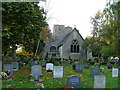
Parish Church of St Peter - Church End Arlesey
Tucked away at the end of Arlesey (which according to local legend, is the longest village in the UK). This claim can be checked using Google if you like - it seems not to be true. The church is a bit run down and has some old wooden crosses in the graveyard.
Image: © Robin Hall
Taken: 30 Oct 2005
0.11 miles
2
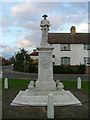
Arlesey war memorial.
This war memorial depicting a first world war soldier is already beginning to deteriorate. The soldier's face is beginning to erode.
Image: © Robin Hall
Taken: 30 Oct 2005
0.11 miles
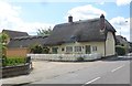
4
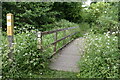
Footbridge between the railway and the River Hiz
On a permissive path, forming part of the Hicca Way.
Image: © David Martin
Taken: 29 May 2022
0.15 miles
6

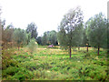
Work is underway on Arlesey relief road
Initial groundwork on a road link that will connect the High Street with the A507, accompanied by extensive additional residential development.
Image: © David Martin
Taken: 13 Nov 2022
0.19 miles
8
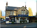
The Vicar's Inn - Church End, Arlesey.
This pub has been re-named and used to be called "The Engine" There is a railway passing nearby. The new name may be related to the church being nearer than the railway.
Image: © Robin Hall
Taken: 30 Oct 2005
0.19 miles
9

Groundwork for Arlesey Relief Road
Initial groundwork on a road link that will connect the High Street with the A507, accompanied by extensive additional residential development.
Image: © David Martin
Taken: 13 Nov 2022
0.20 miles
10

Arlesey church
St. Peter's is a grade I listed building, oldest parts 13th century, with much later addition and alteration.
Image: © Robin Webster
Taken: 12 Nov 2017
0.20 miles