IMAGES TAKEN NEAR TO
Lower Marsh, LONDON, SE1 7NT
Introduction
This page details the photographs taken nearby to Lower Marsh, SE1 7NT by members of the Geograph project.
The Geograph project started in 2005 with the aim of publishing, organising and preserving representative images for every square kilometre of Great Britain, Ireland and the Isle of Man.

There are currently over 7.5m images from over14,400 individuals and you can help contribute to the project by visiting https://www.geograph.org.uk
Image Map
Images are licensed for reuse under creativecommons.org/licenses/by-sa/2.0
Notes
- Clicking on the map will re-center to the selected point.
- The higher the marker number, the further away the image location is from the centre of the postcode.
Image Listing (1166 Images Found)
Images are licensed for reuse under creativecommons.org/licenses/by-sa/2.0
Image
Details
Distance
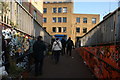
1
View down Grindal Street from Lower Marsh
Looking southeast.
Image: © Robert Lamb
Taken: 14 Sep 2019
0.01 miles
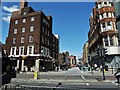
2
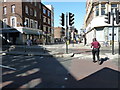
Looking across Westminster Bridge Road across to Lower Marsh
Image: © Basher Eyre
Taken: 10 Jul 2010
0.01 miles
3
Looking from Upper Marsh back to Westminster Bridge Road
Image: © Basher Eyre
Taken: 10 Jul 2010
0.01 miles
4
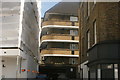
View down Lower Marsh towards Westminster Bridge Road
Looking south-southwest. The block of flats in the distance is in Royal Street.
Image: © Robert Lamb
Taken: 13 Mar 2016
0.01 miles
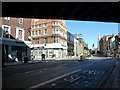
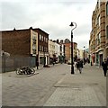
5
Waterloo, London: Lower Marsh
Lower Marsh from Westminster Bridge Road.
Image: © Michael Garlick
Taken: 14 Jun 2013
0.02 miles
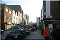
7
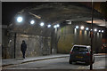
London : Lambeth - Upper Marsh
A road underneath the railway track near Waterloo.
Image: © Lewis Clarke
Taken: 15 Jan 2016
0.02 miles
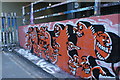
8
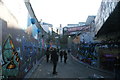
View of the closed off end of Leake Street
Leake Street was closed to through traffic on 14 November 2008 when ownership of the road passed from Eurostar to Network Rail, following the closure of the Waterloo International Eurostar terminal in 2007. The graffiti began to appear in May 2008 when Banksy created a "Cans Festival" and other street artists have followed on since. Looking southeast.
Image: © Robert Lamb
Taken: 13 Mar 2016
0.02 miles
9
View up the pedestrian ramp leading from Leake Street from Lower Marsh
Looking south-southeast.
Image: © Robert Lamb
Taken: 13 Mar 2016
0.02 miles
10
View of street art on the Station Approach Road ramp next to Leake Street #2
Looking south-southwest.
Image: © Robert Lamb
Taken: 13 Mar 2016
0.03 miles