IMAGES TAKEN NEAR TO
Baylis Road, LONDON, SE1 7FN
Introduction
This page details the photographs taken nearby to Baylis Road, SE1 7FN by members of the Geograph project.
The Geograph project started in 2005 with the aim of publishing, organising and preserving representative images for every square kilometre of Great Britain, Ireland and the Isle of Man.

There are currently over 7.5m images from over14,400 individuals and you can help contribute to the project by visiting https://www.geograph.org.uk
Image Map
Images are licensed for reuse under creativecommons.org/licenses/by-sa/2.0
Notes
- Clicking on the map will re-center to the selected point.
- The higher the marker number, the further away the image location is from the centre of the postcode.
Image Listing (1005 Images Found)
Images are licensed for reuse under creativecommons.org/licenses/by-sa/2.0
Image
Details
Distance
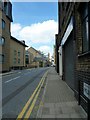
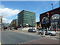
2
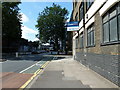
Approaching the junction of Baylis Road and Murphy Street
Image: © Basher Eyre
Taken: 10 Jul 2010
0.02 miles
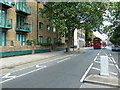
3
Looking from Murphy Street into Baylis Road
Image: © Basher Eyre
Taken: 10 Jul 2010
0.02 miles
6
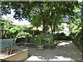
Matheson Lang Gardens
Taken from Baylis Road.
Image: © Basher Eyre
Taken: 10 Jul 2010
0.03 miles
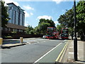
7
Looking up Westminster Bridge Road towards a distant London Eye
Image: © Basher Eyre
Taken: 10 Jul 2010
0.03 miles
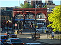
8
Lambeth North Tube Station in early July
Image: © Basher Eyre
Taken: 10 Jul 2010
0.04 miles
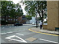
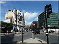
9
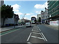
Approaching the junction of Baylis Road and Westminster Bridge Road
Image: © Basher Eyre
Taken: 10 Jul 2010
0.04 miles