IMAGES TAKEN NEAR TO
Baylis Road, LONDON, SE1 7AN
Introduction
This page details the photographs taken nearby to Baylis Road, SE1 7AN by members of the Geograph project.
The Geograph project started in 2005 with the aim of publishing, organising and preserving representative images for every square kilometre of Great Britain, Ireland and the Isle of Man.

There are currently over 7.5m images from over14,400 individuals and you can help contribute to the project by visiting https://www.geograph.org.uk
Image Map
Images are licensed for reuse under creativecommons.org/licenses/by-sa/2.0
Notes
- Clicking on the map will re-center to the selected point.
- The higher the marker number, the further away the image location is from the centre of the postcode.
Image Listing (1137 Images Found)
Images are licensed for reuse under creativecommons.org/licenses/by-sa/2.0
Image
Details
Distance
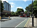
2
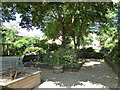
Matheson Lang Gardens
Taken from Baylis Road.
Image: © Basher Eyre
Taken: 10 Jul 2010
0.02 miles
3
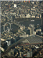
Waterloo railway station and The London Eye from the air
Charing Cross railway station can also be seen on the other side of Hungerford Bridge.
Image: © Thomas Nugent
Taken: 7 Jan 2020
0.03 miles
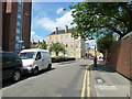
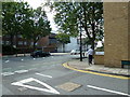
4
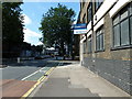
Approaching the junction of Baylis Road and Murphy Street
Image: © Basher Eyre
Taken: 10 Jul 2010
0.03 miles
7
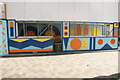
View of a brightly coloured hoarding on Lower Marsh #3
Looking southeast.
Image: © Robert Lamb
Taken: 14 Sep 2019
0.04 miles
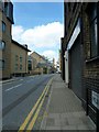
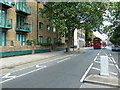
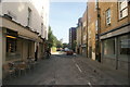
8
Looking from Murphy Street into Baylis Road
Image: © Basher Eyre
Taken: 10 Jul 2010
0.04 miles
9
View down Frazier Street from Lower Marsh
Looking southeast.
Image: © Robert Lamb
Taken: 14 Sep 2019
0.04 miles