1
Sullivan Road barrier
A barrier across the end of Sullivan Road at the junction with Brook Street.
Image: © David P Howard
Taken: 24 Jan 2016
0.06 miles
2
Width restriction on Brook Drive
A centre island and high kerbs have been installed to reduce the width down to 2.2 metres, 7 feet 6 inches, to stop large vehicles using this road.
Image: © David P Howard
Taken: 24 Jan 2016
0.07 miles
3
St Mary's Gardens. Lambeth
St Mary's Gardens were once part of the Walcot estate but the charity only owns a few of the houses now as they sold some off in the 1980's and 90's.
Image: © PAUL FARMER
Taken: 27 Dec 2009
0.09 miles
4
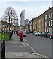
Walcot Square
An attractive spot laid out in 1837-39. All Grade II listed.
Beyond are the Strata building and the Draper Estate at Elephant and Castle (
Image]).
Image: © Stephen Richards
Taken: 12 Mar 2011
0.10 miles
5
Cinema Museum, Kennington
The privately owned but under-threat Cinema Museum is housed in the former Lambeth Workhouse (later Infirmary). For a brief history of the site see this http://landmark.lambeth.gov.uk/display_page.asp?section=landmark&id=8041.
Image: © Jim Osley
Taken: 17 Jan 2018
0.10 miles
6
Tri-partite window, Cinema Museum, Kennington
Fuller view of the building at this
Image]
Image: © Jim Osley
Taken: 31 Jan 2018
0.10 miles
7
Former Lambeth Hospital, Brook Drive
In fact built as the central block of Lambeth Workhouse in 1870-71. Given its function, a surprisingly flamboyant affair of yellow stock brick with red brick, stone and terracotta dressings. Grade II listed.
Much of the workhouse has since gone, what remained was subsumed into Lambeth Infirmary, and is now being converted into flats.
Image: © Stephen Richards
Taken: 12 Mar 2011
0.10 miles
8
Covered washing line
I am unsure whether the building shown here - with washing hung beneath its roof - is part of the original workhouse/hospital - see
Image - or part of the new development but using period architectural ironwork.
Image: © Stephen Craven
Taken: 10 Mar 2012
0.10 miles
9
Austral Street off Brook Drive, Lambeth
Image: © Ian S
Taken: 7 Dec 2010
0.10 miles
10
Ice Age Tree Trail No. 28 - Box (Buxus sempervirens)
The Ice Age Tree Trail in Geraldine Mary Harmsworth Park has specimens of trees native to Britain. Box was the 28th tree to have colonised Britain, arriving about 8000 years ago. It is heavier than water and twice as hard as oak. Unlike other timber, it is sold by weight rather than size. It is long lived and slow growing, hence the small size of this specimen. It reaches a maximum height of 9 metres.
Image: © Rod Allday
Taken: 17 Oct 2010
0.11 miles


