IMAGES TAKEN NEAR TO
Churchyard Row, LONDON, SE11 4FE
Introduction
This page details the photographs taken nearby to Churchyard Row, SE11 4FE by members of the Geograph project.
The Geograph project started in 2005 with the aim of publishing, organising and preserving representative images for every square kilometre of Great Britain, Ireland and the Isle of Man.

There are currently over 7.5m images from over14,400 individuals and you can help contribute to the project by visiting https://www.geograph.org.uk
Image Map
Images are licensed for reuse under creativecommons.org/licenses/by-sa/2.0
Notes
- Clicking on the map will re-center to the selected point.
- The higher the marker number, the further away the image location is from the centre of the postcode.
Image Listing (380 Images Found)
Images are licensed for reuse under creativecommons.org/licenses/by-sa/2.0
Image
Details
Distance
1
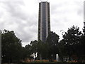
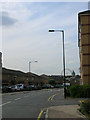
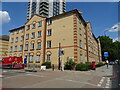
Castilla, Elephant and Castle, Churchyard Row
Taken from St Mary's Churchyard
Image: © Robin Sones
Taken: 29 Aug 2018
0.01 miles
4
St Mary's Churchyard, Elephant and Castle
Image: © PAUL FARMER
Taken: 27 Apr 2016
0.03 miles
6
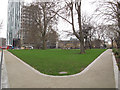
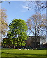
Diverging paths
Two paths provided as part of Southwark Council's recent redevelopment of the former St Mary's Churchyard, diverging at an angle of about 60 degrees.
Historical note: a church existed on this site from Norman times: the latest was built c.1792 and demolished 1875 for road widening. The clock tower remained until at least 1961 but has also now been demolished. The 1876 replacement church Image was on a different site. The churchyard remains
consecrated (because there are still burials within it).
Image: © Stephen Craven
Taken: 10 Mar 2012
0.03 miles
7
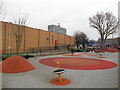
Playground at Newington Butts
A contemporary playground (c.2009) adjacent to the leisure centre (left).
Historical note: the playground occupies the site of the former St Gabriel Mission Church, built in 1874 within St Mary's churchyard to replace the old church which was about to be demolished for road widening. St Gabriel's was itself demolished in 1937. The site was sold for £4 to Southwark Council in 1939 and turned into a park - its value today if sold for development could easily be a million times that!
Image: © Stephen Craven
Taken: 10 Mar 2012
0.03 miles
10
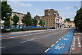
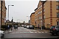
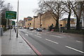
Kennington Park Road
This is the A3, one of the major routes out of London to the south west.
Image: © Bill Boaden
Taken: 2 Aug 2011
0.04 miles