1
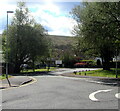
Down Hendreladus, Ystradgynlais
The road named Hendreladus descends towards a school, Ysgol Golwg y Cwm.
Image: © Jaggery
Taken: 6 May 2021
0.01 miles
2
Ystradgynlais Youth Centre
Viewed across the road named Hedreladus on the east side of Brecon Road.
Image: © Jaggery
Taken: 10 May 2016
0.02 miles
3
Powys County Council Hedreladus offices in Ystradgynlais
Accessed from Brecon Road via the road named Hedreladus. Ystradgynlais is in the SW corner of Powys.
Image: © Jaggery
Taken: 10 May 2016
0.03 miles
4
Croeso/Welcome board, Ysgol Golwg y Cwm, Ystradgynlais
At the entrance to this http://www.geograph.org.uk/photo/4945901 primary school.
Image: © Jaggery
Taken: 10 May 2016
0.04 miles
5
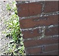
Ordnance Survey Cut Mark
This OS cut mark can be found on the NE face of the Community centre. It marks a point 116.790m above mean sea level.
Image: © Adrian Dust
Taken: 10 Jun 2018
0.05 miles
6
Pelican crossing at the NE edge of Ystradgynlais
Across the B4599 Brecon Road. The Ystradgynlais boundary sign http://www.geograph.org.uk/photo/4947057 is nearby.
Image: © Jaggery
Taken: 10 May 2016
0.05 miles
7
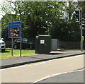
Dark green cabinet near an Ystradgynlais boundary sign
Telecoms cabinet alongside the B4599 Brecon Road at the northeast edge of Ystradgynlais viewed from Penrhos (Powys).
Image: © Jaggery
Taken: 6 May 2021
0.05 miles
8
Northeast boundary of Ystradgynlais
The B4599 Brecon Road from Penrhos enters Ystradgynlais in SW Powys.
Ystradgynlais is the second largest town in Powys, after Newtown.
Their populations on the day of the 2011 Census were 8,092 and 11,357 respectively.
Image: © Jaggery
Taken: 10 May 2016
0.05 miles
9
Mini-roundabout near the northern edge of Ystradgynlais
At the junction of the B4599 Brecon Road and Hedreladus behind the broken white line on the left.
The Ystradgynlais boundary sign http://www.geograph.org.uk/photo/4947057 is on the right.
Image: © Jaggery
Taken: 10 May 2016
0.05 miles
10
Richmond Park, Ystradgynlais
Cul-de-sac on the SE side of Brecon Road.
Image: © Jaggery
Taken: 10 May 2016
0.05 miles


