IMAGES TAKEN NEAR TO
Gorof Road, SWANSEA, SA9 1DS

Introduction

This page details the photographs taken nearby to Gorof Road, SA9 1DS by members of the Geograph project.

The Geograph project started in 2005 with the aim of publishing, organising and preserving representative images for every square kilometre of Great Britain, Ireland and the Isle of Man.

There are currently over 7.5m images from over14,400 individuals and you can help contribute to the project by visiting https://www.geograph.org.uk

Image Map


Images are licensed for reuse under creativecommons.org/licenses/by-sa/2.0
Notes
  • Clicking on the map will re-center to the selected point.
  • The higher the marker number, the further away the image location is from the centre of the postcode.

Image Listing (18 Images Found)

Images are licensed for reuse under creativecommons.org/licenses/by-sa/2.0
Image
Details
Distance
1
Entrance to Coronation Park at Ystradgynlais
Image: © Peter Robinson Taken: 26 Jul 2012
0.03 miles
2
Footbridge over the A4067 at Ystradgynlais
Image: © Peter Robinson Taken: 26 Jul 2012
0.06 miles
3
Ordnance Survey Cut Mark
This OS cut mark can be found on the wall of No11 Gorof Road. It marks a point 83.486m above mean sea level.
Image: © Adrian Dust Taken: 3 May 2020
0.08 miles
4
River Tawe
The River Tawe viewed from the bridge in Ystradgynlais.
Image: © Alan Hughes Taken: 15 May 2018
0.14 miles
5
Ordnance Survey Cut Mark
This damaged OS cut mark can be found on the south parapet of the River Tawe Bridge. It marks a point 77.036m above mean sea level.
Image: © Adrian Dust Taken: 15 Aug 2013
0.16 miles
6
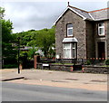
Black signpost near a stone house, Heol Eglwys, Ystradgynlais
The signpost is opposite Gorsedd Park and the River Tawe.
Image: © Jaggery Taken: 20 May 2016
0.18 miles
7
Roadworks in Ystradgynlais
Roadworks on College Row, Ystradgynlais.
Image: © Alan Hughes Taken: 15 May 2018
0.18 miles
8
Inscribed bench near Ystradgynlais War Memorial
The inscription is in Welsh and English on the bench located on the left side here. http://www.geograph.org.uk/photo/4975229 The English text is PRESENTED BY BRECKNOCK BOROUGH COUNCIL 1974-1996 TO COMMEMORATE THE 50TH ANNIVERSARY OF THE END OF WORLD WAR II.
Image: © Jaggery Taken: 20 May 2016
0.19 miles
9
Parachute Regiment Memorial, Ystradgynlais
Located near the War Memorial http://www.geograph.org.uk/photo/4975229 in Gorsedd Park. The Memorial records that the Parachute Regiment was given the Freedom of the Borough of Brecknock on October 25th 1990.
Image: © Jaggery Taken: 20 May 2016
0.19 miles
10
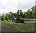
Ystradgynlais War Memorial
Located in the NW corner of Gorsedd Park.
Image: © Jaggery Taken: 20 May 2016
0.19 miles