1
Ordnance Survey Cut Mark
This OS cut mark can be found on No12 Plas Road. It marks a point 123.316m above mean sea level.
Image: © Adrian Dust
Taken: 30 Jan 2014
0.09 miles
2
Mile Stone, Neath 4 miles
This Mile Stone can be found in the garden wall to the NW of Neath Road. It mas an OS cut mark which marks a point 117.531m above mean sea level.
Image: © Adrian Dust
Taken: 30 Jan 2014
0.09 miles
3
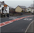
School patrol sign alongside Neath Road, Rhos
The 20mph maximum speed zone is near Rhos Primary School. http://www.geograph.org.uk/photo/3887626
Image: © Jaggery
Taken: 14 Mar 2014
0.10 miles
4
Ordnance Survey Cut Mark
This OS cut mark can be found on the school to the south of Neath Road. It marks a point 111.828m above mean sea level.
Image: © Adrian Dust
Taken: 30 Jan 2014
0.12 miles
5
Rhos Primary School, Rhos
Viewed across the A474 New Road.
Image: © Jaggery
Taken: 14 Mar 2014
0.13 miles
6
Heol-y-Nant, Rhos
Viewed across the A474 New Road. Rhos Primary School http://www.geograph.org.uk/photo/3887626 is on the right.
This junction is the point where the A474 New Road on the west side becomes the A474 Neath Road on the east side.
Image: © Jaggery
Taken: 14 Mar 2014
0.14 miles
7
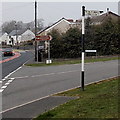
Old style signpost arm in Rhos
Located on the corner of the A474 Neath Road and Plas Road.
The distance shown to Cil-y-Bebyll is the very precise one mile one and a quarter furlongs. http://www.geograph.org.uk/photo/133394
Image: © Jaggery
Taken: 14 Mar 2014
0.14 miles
8
Rhos Stores and Post Office, Rhos
Located at 67 Neath Road.
Image: © Jaggery
Taken: 14 Mar 2014
0.16 miles
9
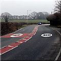
30 to 20 along New Road, Rhos
The 30mph speed limit on the A474 lowers to 20mph on the approach to Rhos Primary School. http://www.geograph.org.uk/photo/3887626
Image: © Jaggery
Taken: 14 Mar 2014
0.16 miles
10
Signpost at Rhos, near Pontardawe
No "roughly" here! The distance to Cilybebyll is one mile one and a quarter furlongs (2,035 yards) precisely...
Image: © Kevin Flynn
Taken: 6 Mar 2006
0.16 miles


