1
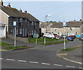
Northern end of Jetty Road, Milford Haven
Jetty Road heads away from Hubberston towards the edge of Gelliswick Bay.
The Murco Petroleum Ltd sign on the right states that this is a private road.
There is a 20mph speed limit along Jetty Road, which the sign describes as a
"narrow road with speed bumps, bends and ditches. Authorised vehicles only."
The final sentences are
"Persons using this road do so at their own risk. The company accepts no liability what so ever".
Two spaces have been inserted into the usual spelling of whatsoever, perhaps for emphasis.
Image: © Jaggery
Taken: 31 Aug 2012
0.05 miles
2
Speeds bumps ahead, Jetty Road, Milford Haven
Jetty Road ahead is between the edge of Milford Haven Golf Course on the right and
land sloping downwards on the left, beyond the barrier at the edge of the road.
Image: © Jaggery
Taken: 31 Aug 2012
0.07 miles
3
Western boundary of Hubberston
Hubberston is a district in the north of Milford Haven. The right turn is into Jetty Road. http://www.geograph.org.uk/photo/3179345
Image: © Jaggery
Taken: 31 Aug 2012
0.09 miles
4
NW boundary of Milford Haven
The road from Herbrandston reaches Milford Haven.
The Welsh name Aberdaugleddau is literally "mouth of the two (Rivers) Cleddau".
Image: © Jaggery
Taken: 31 Aug 2012
0.10 miles
5
Croft Avenue houses, Hakin, Milford Haven
Viewed from the corner of Haven Drive.
Image: © Jaggery
Taken: 11 Mar 2019
0.11 miles
6
Awaiting Development
Permission has been granted for 168 houses on this site, but presumably the 2008/9 recession has caused the development to stall.
Image: © Peter Whatley
Taken: 23 Jul 2009
0.12 miles
7
Jetty Road descends towards Gelliswick Bay, Milford Haven
Jetty Road ahead is between the edge of Milford Haven Golf Course on the right and
land sloping downwards on the left, beyond the barrier at the edge of the road.
Image: © Jaggery
Taken: 31 Aug 2012
0.13 miles
8
Road To Milford Haven
Image: © Peter Whatley
Taken: 23 Jul 2009
0.14 miles
9
One-way signs, Haven Drive, Hakin, Milford Haven
The signs face Croft Avenue.
Image: © Jaggery
Taken: 11 Mar 2019
0.16 miles
10
Footpath through the valley
Following the banks of the stream,
Image: © Deborah Tilley
Taken: 14 Feb 2009
0.16 miles


