IMAGES TAKEN NEAR TO
Hakin Ville, MILFORD HAVEN, SA73 3DD

Introduction

This page details the photographs taken nearby to Hakin Ville, SA73 3DD by members of the Geograph project.

The Geograph project started in 2005 with the aim of publishing, organising and preserving representative images for every square kilometre of Great Britain, Ireland and the Isle of Man.

There are currently over 7.5m images from over14,400 individuals and you can help contribute to the project by visiting https://www.geograph.org.uk

Image Map


Images are licensed for reuse under creativecommons.org/licenses/by-sa/2.0
Notes
  • Clicking on the map will re-center to the selected point.
  • The higher the marker number, the further away the image location is from the centre of the postcode.

Image Listing (78 Images Found)

Images are licensed for reuse under creativecommons.org/licenses/by-sa/2.0
  • ...
Image
Details
Distance
1
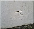
Ordnance Survey Cut Mark
This OS cut mark can be found on the Methodist Chapel, Chapel Street. It marks a point 18.190m above mean sea level.
Image: © Adrian Dust Taken: 28 Sep 2019
0.06 miles
2
Ordnance Survey Cut Mark
This OS cut mark can be found on the wall west side of Chapel Street. It marks a point 13.190m above mean sea level.
Image: © Adrian Dust Taken: 28 Sep 2019
0.08 miles
3
Houses at Hakin Point
Image: © M J Roscoe Taken: 23 Oct 2023
0.08 miles
4
St Mary's Church, Hubberston and Hakin
Image: © Shaun Butler Taken: 8 Oct 2008
0.08 miles
5
The Quay, Hakin Point
Houses, on private cul-de-sac, overlooking the Cleddau.
Image: © M J Roscoe Taken: 23 Oct 2023
0.09 miles
6
The Point, Hakin
Image: © Oscar Taylor Taken: 16 Jul 2024
0.10 miles
7
Hakin Point, Hakin
Image: © Oscar Taylor Taken: 16 Jul 2024
0.10 miles
8
Heart of Oak B&B, Milford Haven
Heart of Oak B&B,Lower Hill Street,Hakin,Milford Haven.
Image: © Arthur C Harris Taken: 29 Sep 2014
0.10 miles
9
Military structure at Hakin Point
Not too sure of the precise nature of this structure, possibly wartime, like to hear what it is, if anyone can oblige. November 2020. I am grateful to Geograph member FRED, who informs me that the structure is an old sewer pumping outfall building.
Image: © Arthur C Harris Taken: 29 Apr 2015
0.11 miles
10
Hakin Methodist School House and Chapel
On the road down to Hakin Point. The Chapel entrance is at the far end, and very overgrown. So far I have been unable to find out anything about this building.
Image: © Shaun Butler Taken: 8 Oct 2008
0.11 miles
  • ...