IMAGES TAKEN NEAR TO
Vicary Street, MILFORD HAVEN, SA73 2QJ

Introduction

This page details the photographs taken nearby to Vicary Street, SA73 2QJ by members of the Geograph project.

The Geograph project started in 2005 with the aim of publishing, organising and preserving representative images for every square kilometre of Great Britain, Ireland and the Isle of Man.

There are currently over 7.5m images from over14,400 individuals and you can help contribute to the project by visiting https://www.geograph.org.uk

Image Map


Images are licensed for reuse under creativecommons.org/licenses/by-sa/2.0
Notes
  • Clicking on the map will re-center to the selected point.
  • The higher the marker number, the further away the image location is from the centre of the postcode.

Image Listing (60 Images Found)

Images are licensed for reuse under creativecommons.org/licenses/by-sa/2.0
  • ...
Image
Details
Distance
1
The Rath
Llwybr yr arfordir yn mynd ar hyd y Rath. Coastal path going along The Rath.
Image: © Alan Richards Taken: 30 Jul 1997
0.08 miles
2
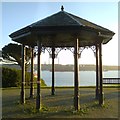
Shelter at eastern end of The Rath
Shelter with a view over the estuary towards the refinery at Rhoscrowther on the south shore.
Image: © Gordon Hatton Taken: 20 Oct 2012
0.08 miles
3
The Rath
View along the promenade
Image: © Eirian Evans Taken: 31 Aug 2022
0.08 miles
4
Pill Corner Store
At the junction of Pill Lane and Murray Road
Image: © Eirian Evans Taken: 31 Aug 2022
0.09 miles
5
The Pembrokeshire Coast Path at Pill
Image: © Dave Kelly Taken: 9 May 2017
0.09 miles
6
Ordnance Survey Cut Mark
This OS cut mark can be found on No63 Pill Lane. It marks a point 34.156m above mean sea level.
Image: © Adrian Dust Taken: 28 Mar 2022
0.10 miles
7
Dedication plaque (2) on the R.N.M.D. memorial
Image: © Shaun Butler Taken: 4 Sep 2008
0.11 miles
8
Side view of the R.N.M.D. memorial
The memorial (see: Image ) takes the form of a marine mine and launching trolley. The small wheels on the trolley were for the rail system used at the storage and arming depot. The unarmed mines arrived by standard gauge rail, and were off-loaded on to the narrow gauge, and stored in a series of tunnels cut into the hillside. They were subsequently armed and loaded on to minelayers for deployment at various locations around the British Isles and further afield.
Image: © Shaun Butler Taken: 4 Sep 2008
0.12 miles
9
Memorial to R.N.M.D on the Rath
Memorial dedicated to the R.N.M.D. The disused minelaying depot can be seen left of centre. The plaque reads: “Dedicated to the workforce of R.N.M.D. Milford Haven without whose effort fast minelaying operations would not have been possible.” There are two other dedication plaques on the sides of the launching base. See Image and Image
Image: © Shaun Butler Taken: 4 Sep 2008
0.12 miles
10
Eastern end of waterside walk, Pill
Gate and squeeze stile at end of road down from Vicary Crescent. The houses on the skyline are on The Rath.
Image: © M J Roscoe Taken: 24 Aug 2023
0.12 miles
  • ...