IMAGES TAKEN NEAR TO
Yorke Street, MILFORD HAVEN, SA73 2LL
Introduction
This page details the photographs taken nearby to Yorke Street, SA73 2LL by members of the Geograph project.
The Geograph project started in 2005 with the aim of publishing, organising and preserving representative images for every square kilometre of Great Britain, Ireland and the Isle of Man.

There are currently over 7.5m images from over14,400 individuals and you can help contribute to the project by visiting https://www.geograph.org.uk
Image Map (Loading...)


Getting Data...Please wait
Leaflet Map data © OpenStreetMap
Images are licensed for reuse under creativecommons.org/licenses/by-sa/2.0
Notes
- Clicking on the map will re-center to the selected point.
- The higher the marker number, the further away the image location is from the centre of the postcode.
Image Listing (104 Images Found)
Images are licensed for reuse under creativecommons.org/licenses/by-sa/2.0
Image
Details
Distance
1
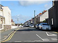
Yorke Street, Milford Haven
On the east side of the A4076 Great North Road.
Image: © Jaggery
Taken: 5 Sep 2017
0.03 miles
5
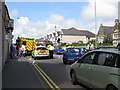
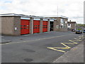
Accident On Great North Road, Milford Haven
The blue car near the pedestrian crossing allegedly failed to stop when the truck in front halted at Yorke Street. Traffic was severely delayed on all routes into Milford Haven while oil was cleared from the road by the fire brigade (based very close by in Yorke Street).
Image: © Peter Whatley
Taken: 23 Jul 2009
0.06 miles
6
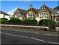
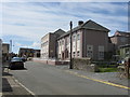
Elizabeth Venmore Court, Milford Haven
The Great North Road side of flats on the corner of Yorke Street. Dated 1900, the building is the former Lower Central School which was converted to flats in the early 21st century.
Image: © Jaggery
Taken: 5 Sep 2017
0.06 miles
8
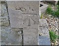
Ordnance Survey Cut Mark
This OS cut mark can be found on the old school/retirement home. It marks a point 51.859m above mean sea level.
Image: © Adrian Dust
Taken: 28 Sep 2019
0.07 miles
9
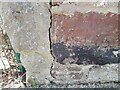
Ordnance Survey Cut Mark
This OS cut mark can be found on a building south side of Pill Lane. It marks a point 40.751m above mean sea level.
Image: © Adrian Dust
Taken: 28 Mar 2022
0.08 miles
10
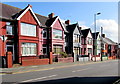
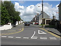
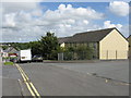
Great North Road houses, Milford Haven
Houses on the east side of the A4076 Great North Road, south of Yorke Street.
Image: © Jaggery
Taken: 5 Sep 2017
0.08 miles