1
Ordnance Survey Rivet
This OS rivet can be found on the steps at the junction of Fulke Street & Roberts Street. It marks a point 43.298m above mean sea level.
Image: © Adrian Dust
Taken: 28 Sep 2019
0.03 miles
2
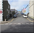
Fulke Street, Milford Haven
Viewed across Hamilton Terrace.
Image: © Jaggery
Taken: 31 Aug 2012
0.06 miles
3
Looking down Fulke Street, Milford Haven
Image: © Jeff Gogarty
Taken: 3 Jun 2016
0.06 miles
4
Ordnance Survey Cut Mark
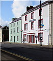
This OS cut mark can be found on the Old Liberal Club building which is now a corner shop. It marks a point 37.325m above mean sea level.
Image: © Adrian Dust
Taken: 8 Nov 2015
0.06 miles
5
Francis Street, Milford Haven
Viewed from Hamilton Terrace. A one-way traffic system operates along Francis Street.
Image: © Jaggery
Taken: 31 Aug 2012
0.07 miles
6
On-street parking, Francis Street, Milford Haven
One-way Francis Street ascends to Charles Street and Robert Street from the A4076 Hamilton Terrace.
Image: © Jaggery
Taken: 5 Sep 2017
0.07 miles
7
Priory Road, Milford Haven
Looking towards the waters of Milford Haven where an oil tanker is offloading.
Image: © Stephen McKay
Taken: 24 Aug 2010
0.08 miles
8
Repainting the Belhaven House Hotel, Milford Haven
The Hamilton Terrace hotel is being repainted in early September 2017.
The national flag of Wales and the flag of Pembrokeshire are in view.
Dating from the 1790s, this was one of the first buildings erected in Milford Haven.
It may have been the bakery set up for the Nantucket whaling fleet by Timothy Folger,
one of the leaders of the North American whalers invited to Milford in 1792.
Grade II listed in 1993.
Image: © Jaggery
Taken: 5 Sep 2017
0.08 miles
9
The Trafalgar, Milford Haven
The Trafalgar,Charles Street,Milford Haven.
Image: © Arthur C Harris
Taken: 2 Oct 2014
0.08 miles
10
Friends' Meeting House
The date above the door is 1811. The Meeting House in Priory Road was established by the Quaker whalers from Nantucket who were persuaded to settle in the town at the end of the C18 with the aim of establishing a whaling industry here.
Image: © Natasha Ceridwen de Chroustchoff
Taken: 26 Oct 2007
0.08 miles


