IMAGES TAKEN NEAR TO
Middle Street, MILFORD HAVEN, SA73 1JP

Introduction

This page details the photographs taken nearby to Middle Street, SA73 1JP by members of the Geograph project.

The Geograph project started in 2005 with the aim of publishing, organising and preserving representative images for every square kilometre of Great Britain, Ireland and the Isle of Man.

There are currently over 7.5m images from over14,400 individuals and you can help contribute to the project by visiting https://www.geograph.org.uk

Image Map


Images are licensed for reuse under creativecommons.org/licenses/by-sa/2.0
Notes
  • Clicking on the map will re-center to the selected point.
  • The higher the marker number, the further away the image location is from the centre of the postcode.

Image Listing (9 Images Found)

Images are licensed for reuse under creativecommons.org/licenses/by-sa/2.0
Image
Details
Distance
1
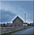
Tabernacle, Rosemarket
Tabernacle Chapel Rosemarket was built in 1831. It serves members of the United Reformed Church. Early in the century over a hundred people attended services.
Image: © Deborah Tilley Taken: 2 Feb 2015
0.13 miles
2
The Huntsman Inn, Rosemarket
Image: © Jennifer Luther Thomas Taken: 11 Aug 2006
0.14 miles
3
Pembrokeshire Pubs: Huntsman's Inn, Rosemarket
Image: © Shaun Butler Taken: 29 Sep 2008
0.14 miles
4
The recycling point at Rosemarket
Next to the cemetery!
Image: © David Medcalf Taken: 12 Aug 2022
0.15 miles
5
St Ishmael's Parish Church, Rosemarket
Rosemarket (="market in Rhos") was an important place before Haverfordwest existed. The church is dedicated to the "patron saint" of the cantref of Rhos, whose mother church was in Image, although the Norman invaders re-dedicated it to their own favoured saint, Leonard.
Image: © Dylan Moore Taken: 29 Oct 2013
0.16 miles
6
Buildings at Rosemarket
Image: © David Medcalf Taken: 12 Aug 2022
0.17 miles
7
Roadside Well Near Rosemarket
I cannot find any history to it
Image: © Deborah Tilley Taken: 2 Feb 2015
0.19 miles
8
Rosemarket Rath viewed from the Brunel Trail
The earthworks are part of a defended enclosure or hill fort dating back to the Iron Age. It may have been used as a castle in the Middle Ages.
Image: © Simon Mortimer Taken: 11 Aug 2012
0.22 miles
9
Entrance to the Brunel Trail near Rosemarket
Looking north towards Johnston. The cycle route runs along the course of the old railway between Neyland and Johnston.
Image: © Simon Mortimer Taken: 11 Aug 2012
0.24 miles