IMAGES TAKEN NEAR TO
PEMBROKE, SA71 5QA
Introduction
This page details the photographs taken nearby to SA71 5QA by members of the Geograph project.
The Geograph project started in 2005 with the aim of publishing, organising and preserving representative images for every square kilometre of Great Britain, Ireland and the Isle of Man.

There are currently over 7.5m images from over14,400 individuals and you can help contribute to the project by visiting https://www.geograph.org.uk
Image Map
Images are licensed for reuse under creativecommons.org/licenses/by-sa/2.0
Notes
- Clicking on the map will re-center to the selected point.
- The higher the marker number, the further away the image location is from the centre of the postcode.
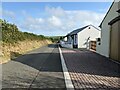
Image Listing (11 Images Found)
Images are licensed for reuse under creativecommons.org/licenses/by-sa/2.0
Image
Details
Distance
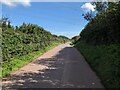
1
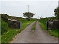
Entrance to Mountain View
Entrance and drive to Mountain View to the east of Maiden Wells.
Image: © Philip Halling
Taken: 16 May 2019
0.09 miles
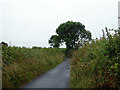
3
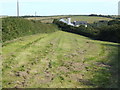
Kingston Hill
This scene is south of Pembroke overlooking cottages and rolling countryside.
Image: © Jonathan Billinger
Taken: 9 Aug 2007
0.13 miles
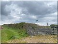
4
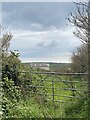
Disused gated track
Leading to St John’s Down.
Image: © Alan Hughes
Taken: 23 Apr 2023
0.18 miles