IMAGES TAKEN NEAR TO
PEMBROKE, SA71 5PY
Introduction
This page details the photographs taken nearby to SA71 5PY by members of the Geograph project.
The Geograph project started in 2005 with the aim of publishing, organising and preserving representative images for every square kilometre of Great Britain, Ireland and the Isle of Man.

There are currently over 7.5m images from over14,400 individuals and you can help contribute to the project by visiting https://www.geograph.org.uk
Image Map
Images are licensed for reuse under creativecommons.org/licenses/by-sa/2.0
Notes
- Clicking on the map will re-center to the selected point.
- The higher the marker number, the further away the image location is from the centre of the postcode.
Image Listing (4 Images Found)
Images are licensed for reuse under creativecommons.org/licenses/by-sa/2.0
Image
Details
Distance
1
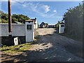
No popping or baking
The Gallows pop-up Café had not popped up and the Cake Hut was very much closed. A disappointment for hot & thirsty cyclists.
Image: © David Medcalf
Taken: 16 Aug 2023
0.05 miles
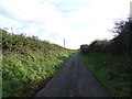
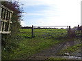
4
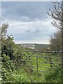
Disused gated track
Leading to St John’s Down.
Image: © Alan Hughes
Taken: 23 Apr 2023
0.21 miles