IMAGES TAKEN NEAR TO
Ashleigh Gardens, PEMBROKE, SA71 4AR
Introduction
This page details the photographs taken nearby to Ashleigh Gardens, SA71 4AR by members of the Geograph project.
The Geograph project started in 2005 with the aim of publishing, organising and preserving representative images for every square kilometre of Great Britain, Ireland and the Isle of Man.

There are currently over 7.5m images from over14,400 individuals and you can help contribute to the project by visiting https://www.geograph.org.uk
Image Map
Images are licensed for reuse under creativecommons.org/licenses/by-sa/2.0
Notes
- Clicking on the map will re-center to the selected point.
- The higher the marker number, the further away the image location is from the centre of the postcode.
Image Listing (54 Images Found)
Images are licensed for reuse under creativecommons.org/licenses/by-sa/2.0
Image
Details
Distance
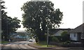
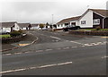
1
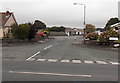
Ashleigh Gardens, Pembroke
A cul-de-sac on the south side of the A4139 Upper Lamphey Road.
Image: © Jaggery
Taken: 12 Sep 2013
0.01 miles
2
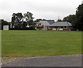
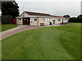
Pembroke Cricket Club pavilion
The pavilion is in the SW corner of the cricket ground located on the south side of the A4139 Upper Lamphey Road.
Image: © Jaggery
Taken: 12 Sep 2013
0.06 miles
4
Vicarage Fields, Pembroke
A cul-de-sac on the north side of the A4139 Upper Lamphey Road.
Image: © Jaggery
Taken: 12 Sep 2013
0.07 miles
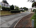
5
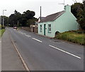
Upper Lamphey Road Pembroke
The A4139 Upper Lamphey Road heads away from central Pembroke towards the village of Lamphey.
Image: © Jaggery
Taken: 12 Sep 2013
0.08 miles
6
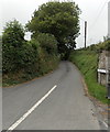
First Lane Pembroke
First Lane heads north away from Upper Lamphey Road
towards Holyland Road, about 400 metres ahead.
Image: © Jaggery
Taken: 12 Sep 2013
0.08 miles
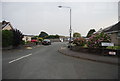
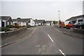
8
Croeso Road Pembroke
Viewed across the A4139 Upper Lamphey Road. Croeso Road leads to Charles Road.
Image: © Jaggery
Taken: 12 Sep 2013
0.10 miles
9
Pembroke Rugby Football Club clubhouse
The clubhouse is at the western end of the rugby ground on the north side of Upper Lamphey Road.
Image: © Jaggery
Taken: 12 Sep 2013
0.10 miles