IMAGES TAKEN NEAR TO
Gumfreston, TENBY, SA70 8RA
Introduction
This page details the photographs taken nearby to SA70 8RA by members of the Geograph project.
The Geograph project started in 2005 with the aim of publishing, organising and preserving representative images for every square kilometre of Great Britain, Ireland and the Isle of Man.

There are currently over 7.5m images from over14,400 individuals and you can help contribute to the project by visiting https://www.geograph.org.uk
Image Map
Images are licensed for reuse under creativecommons.org/licenses/by-sa/2.0
Notes
- Clicking on the map will re-center to the selected point.
- The higher the marker number, the further away the image location is from the centre of the postcode.
Image Listing (98 Images Found)
Images are licensed for reuse under creativecommons.org/licenses/by-sa/2.0
Image
Details
Distance
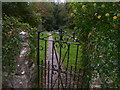
2
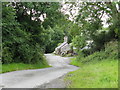
House under repair at Gumfreston
This is the entrance to the new part of the village, up the hill from the old part including the church.
Image: © Colin Bell
Taken: 16 Jun 2008
0.04 miles
4
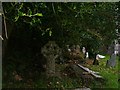
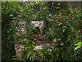
St Lawrence Church Gumfreston - graveyard
Old Celtic Cross under trees.
Image: © welshbabe
Taken: 18 Oct 2015
0.08 miles
5
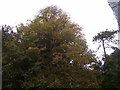
St Lawrence Church Gumfreston - autumn trees
Image: © welshbabe
Taken: 18 Oct 2015
0.08 miles
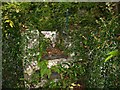
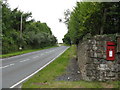
7
St Lawrence Church Gumfreston - stile post detail
Image: © welshbabe
Taken: 18 Oct 2015
0.08 miles
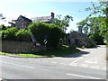
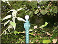
9
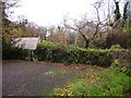
St Lawrence Church Gumfreston - small carpark
Image: © welshbabe
Taken: 16 Nov 2015
0.09 miles