IMAGES TAKEN NEAR TO
Manorbier, TENBY, SA70 8PU
Introduction
This page details the photographs taken nearby to SA70 8PU by members of the Geograph project.
The Geograph project started in 2005 with the aim of publishing, organising and preserving representative images for every square kilometre of Great Britain, Ireland and the Isle of Man.

There are currently over 7.5m images from over14,400 individuals and you can help contribute to the project by visiting https://www.geograph.org.uk
Image Map
Images are licensed for reuse under creativecommons.org/licenses/by-sa/2.0
Notes
- Clicking on the map will re-center to the selected point.
- The higher the marker number, the further away the image location is from the centre of the postcode.
Image Listing (5 Images Found)
Images are licensed for reuse under creativecommons.org/licenses/by-sa/2.0
Image
Details
Distance
3
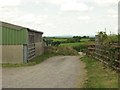
Farm entrance with fine views of the Preselli hills
Image: © Colin Bell
Taken: 16 Jun 2008
0.16 miles
4
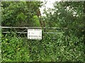
An unnecessary threat?
The land beyond this gate is so overgrown that trespass seems impossible.
Image: © Colin Bell
Taken: 16 Jun 2008
0.17 miles
5
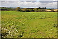
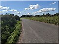
Field near The Glom Farm
Field beside the road along the Ridgeway near The Glom Farm.
Image: © Philip Halling
Taken: 17 Sep 2011
0.20 miles