IMAGES TAKEN NEAR TO
Holloway Court, TENBY, SA70 7NX
Introduction
This page details the photographs taken nearby to Holloway Court, SA70 7NX by members of the Geograph project.
The Geograph project started in 2005 with the aim of publishing, organising and preserving representative images for every square kilometre of Great Britain, Ireland and the Isle of Man.

There are currently over 7.5m images from over14,400 individuals and you can help contribute to the project by visiting https://www.geograph.org.uk
Image Map
Images are licensed for reuse under creativecommons.org/licenses/by-sa/2.0
Notes
- Clicking on the map will re-center to the selected point.
- The higher the marker number, the further away the image location is from the centre of the postcode.
Image Listing (13 Images Found)
Images are licensed for reuse under creativecommons.org/licenses/by-sa/2.0
Image
Details
Distance
3
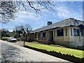
The car park at the sports ground
Near Penally.
Image: © David Medcalf
Taken: 16 Aug 2023
0.18 miles
4
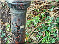
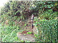
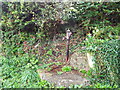
Old Water Pump, Holloway Hill, Penally
Maker's detail
Image: © welshbabe
Taken: 25 Sep 2021
0.19 miles
8
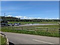
Looking up the Ritec Valley from The Ridgeway
Image: © Angela Jones
Taken: 7 Apr 2006
0.20 miles
9
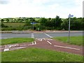
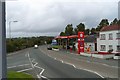
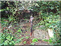
Junction in a junction
A cycle path junction inside the triangle of the road junction. A confusing and possibly dangerous junction - the flowers in the background suggest a recent road accident.
Image: © Colin Bell
Taken: 16 Jun 2008
0.21 miles
10
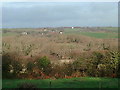
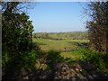
Gumfreston from Frankleston
The view is across the Ritec River valley towards Gumfreston taken from the slopes of the Ridgeway an ancient road between Tenby and Pembroke.
Image: © Angela Jones
Taken: 24 Dec 2001
0.22 miles