IMAGES TAKEN NEAR TO
Sandy Hill Road, SAUNDERSFOOT, SA69 9HR
Introduction
This page details the photographs taken nearby to Sandy Hill Road, SA69 9HR by members of the Geograph project.
The Geograph project started in 2005 with the aim of publishing, organising and preserving representative images for every square kilometre of Great Britain, Ireland and the Isle of Man.

There are currently over 7.5m images from over14,400 individuals and you can help contribute to the project by visiting https://www.geograph.org.uk
Image Map
Images are licensed for reuse under creativecommons.org/licenses/by-sa/2.0
Notes
- Clicking on the map will re-center to the selected point.
- The higher the marker number, the further away the image location is from the centre of the postcode.
Image Listing (57 Images Found)
Images are licensed for reuse under creativecommons.org/licenses/by-sa/2.0
Image
Details
Distance
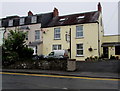
1
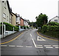
Sandy Hill Road, Saundersfoot
Ascending from the B4316.
Image: © Jaggery
Taken: 16 Jul 2016
0.11 miles
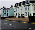
2
Rhodewood, Saundersfoot
Viewed across the B4316 St Brides Hill past the corner of Sandy Hill Road.
Rhodewood is a luxury development of apartments and town houses built c2010.
Image: © Jaggery
Taken: 16 Jul 2016
0.15 miles
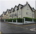
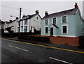
3
St Brides Hill houses, Saundersfoot
Houses on the east side of the B4316 St Brides Hill.
Image: © Jaggery
Taken: 16 Jul 2016
0.16 miles
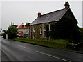
4
Merlewood Hotel, Saundersfoot
Set back 50 metres from the west side of the B4316 St Brides Hill.
Image: © Jaggery
Taken: 16 Jul 2016
0.17 miles
5
Springfield Guest House, St Brides Hill, Saundersfoot
Overlooking Saundersfoot Bay.
Image: © Jaggery
Taken: 16 Jul 2016
0.17 miles
6
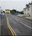
No parking in Stammers Road, Saundersfoot
Double yellow lines on both sides indicate no parking at any time.
Image: © Jaggery
Taken: 16 Jul 2016
0.17 miles
7
Woodlands Hotel, St Brides Hill, Saundersfoot
Overlooking Saundersfoot Bay.
Image: © Jaggery
Taken: 16 Jul 2016
0.18 miles
8
Nythfa Guesthouse and Cottage, St Brides Hill, Saundersfoot
Overlooking Saundersfoot Bay.
Image: © Jaggery
Taken: 16 Jul 2016
0.18 miles
9
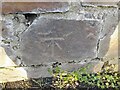
Ordnance Survey Cut Mark
This OS cut mark can be found on the wall of Rhodewood Lodge. It marks a point 45.228m above mean sea level.
Image: © Adrian Dust
Taken: 7 Apr 2022
0.18 miles
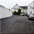
10
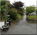
Stammers Lane, Saundersfoot
Stammers Lane ascends from the B4316 in the south of Saundersfoot.
Image: © Jaggery
Taken: 16 Jul 2016
0.18 miles