1
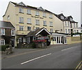
Approaching the centre of Saundersfoot from the north
The harbour and beach are to the left and Cambrian Terrace is on the right.
Image: © Robin Drayton
Taken: 20 Mar 2009
0.01 miles
2
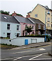
Colourful cottages, Saundersfoot
On the one way system when leaving Saundersfoot to the north.
Image: © Robin Drayton
Taken: 20 Mar 2009
0.01 miles
3
The Gower Hotel, Saundersfoot
Located in Milford Terrace.
Image: © Jaggery
Taken: 16 Jul 2016
0.02 miles
4
The Gower Hotel, Saundersfoot
Image: © Peter Whatley
Taken: 24 Jul 2009
0.02 miles
5
Milford Terrace houses, Saundersfoot
The taller building on the right is the Gower Hotel. http://www.geograph.org.uk/photo/5036871
Image: © Jaggery
Taken: 16 Jul 2016
0.02 miles
6
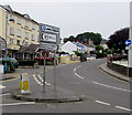
Direction signs in the middle of a Saundersfoot junction
Left for a car and coach park, WC (public toilets) http://www.geograph.org.uk/photo/5036955 and an information centre.
To the right up the hill for the police station.
The Gower Hotel, Milford Terrace http://www.geograph.org.uk/photo/5036871 is in the background.
Image: © Jaggery
Taken: 16 Jul 2016
0.03 miles
7
Milford Street electricity substation, Saundersfoot
The Western Power Distribution electricity substation is set back from the south side of Milford Street.
Image: © Jaggery
Taken: 16 Jul 2016
0.04 miles
8
Quiet Booths Amusement Arcade, Saundersfoot
Image: © welshbabe
Taken: 22 Feb 2016
0.05 miles
9
Coastal service 352 bus in Milford Street, Saundersfoot, Pembs
The bus is stopped at the bus stop outside Booth Enterprises amusement arcade. It is en route to the neighbouring coastal resort of Tenby. The bus is an Optare Solo model M710 registration YJ10 EXU. In 2019 the service 352 (Tenby - Kilgetty via Saundersford) is operated by Taf Valley Coaches on behalf of Pembrokeshire County Council. Possibly that was the case when this photo was taken but as at April 2019 this particular bus was operated by Edward Brothers of Haverfordwest on other routes.
Image: © P L Chadwick
Taken: 4 Apr 2015
0.05 miles
10
High Street, Saundersfoot
Thomas Memorial Congregational Church, built in 1899, is on the left.
Image: © Robin Drayton
Taken: 20 Mar 2009
0.05 miles


