IMAGES TAKEN NEAR TO
SAUNDERSFOOT, SA69 9BD
Introduction
This page details the photographs taken nearby to SA69 9BD by members of the Geograph project.
The Geograph project started in 2005 with the aim of publishing, organising and preserving representative images for every square kilometre of Great Britain, Ireland and the Isle of Man.

There are currently over 7.5m images from over14,400 individuals and you can help contribute to the project by visiting https://www.geograph.org.uk
Image Map
Images are licensed for reuse under creativecommons.org/licenses/by-sa/2.0
Notes
- Clicking on the map will re-center to the selected point.
- The higher the marker number, the further away the image location is from the centre of the postcode.
Image Listing (100 Images Found)
Images are licensed for reuse under creativecommons.org/licenses/by-sa/2.0
Image
Details
Distance
1
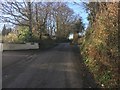
Errox Hill
Errox Hill heading up past Stonecross
Image: © Shaun Ferguson
Taken: 7 Apr 2018
0.03 miles
4
St Issells graveyard, Saundersfoot - lane at side
Image: © welshbabe
Taken: 4 May 2016
0.15 miles
5
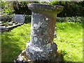
St Issells Church and grave with crest, Saundersfoot
Image: © welshbabe
Taken: 4 May 2016
0.15 miles
6
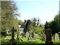
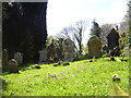
St Issells Church and graveyard, Saundersfoot
Image: © welshbabe
Taken: 4 May 2016
0.16 miles
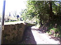
7
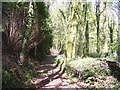
St Issells Church, Saundersfoot - private woodland path
Image: © welshbabe
Taken: 4 May 2016
0.16 miles
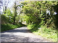
8
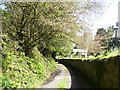
St Issells graveyard, Saundersfoot - lane at side
Image: © welshbabe
Taken: 4 May 2016
0.16 miles
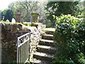
10
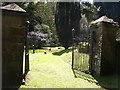
St Issells Church and graveyard, Saundersfoot - side gateway
Image: © welshbabe
Taken: 4 May 2016
0.17 miles