
IMAGES TAKEN NEAR TO
Trewyddfa Road, SWANSEA, SA6 8PE
Introduction
This page details the photographs taken nearby to Trewyddfa Road, SA6 8PE by members of the Geograph project.
The Geograph project started in 2005 with the aim of publishing, organising and preserving representative images for every square kilometre of Great Britain, Ireland and the Isle of Man.

There are currently over 7.5m images from over14,400 individuals and you can help contribute to the project by visiting https://www.geograph.org.uk
Image Map
Images are licensed for reuse under creativecommons.org/licenses/by-sa/2.0
Notes
- Clicking on the map will re-center to the selected point.
- The higher the marker number, the further away the image location is from the centre of the postcode.
Image Listing (6 Images Found)
Images are licensed for reuse under creativecommons.org/licenses/by-sa/2.0
Image
Details
Distance
1
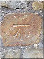
Ordnance Survey Cut Mark
This OS cut mark can be found on No371 Trewyddfa Road. It marks a point 116.031m above mean sea level.
Image: © Adrian Dust
Taken: 16 Jul 2014
0.02 miles
2
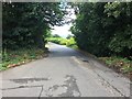
Trewyddfa Road
Road through a patch of woodland at Trewyddfa Fach.
Image: © Alan Hughes
Taken: 10 Aug 2018
0.17 miles
3
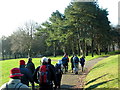
Parc Llewelyn Park
Cerddwyr yn mynd drwy Barc Llewelyn a agrowyd yn 1878. Rhoddwyd y tir ar Ffarm Cnap Llwyd gan y cyfoethog John Dillwyn Llewelyn o Blas Penllergaer.
Walkers going through Parc Llewelyn which was opened in 1878. The land on Cnap Llwyd Farm (trans. brown hill) was donated by the wealthy John Dillwyn Llewelyn of Penllergaer Mansion.
Image: © Alan Richards
Taken: 28 Dec 2008
0.18 miles
4
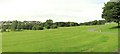
Llewelyn Park
A large and sprawling park on a hillside.
Image: © Nigel Davies
Taken: 31 Jul 2005
0.20 miles
5

Ordnance Survey Rivet
This OS rivet can be found on the wall at the road junction. It marks a point 92.684m above mean sea level.
Image: © Adrian Dust
Taken: 10 Mar 2026
0.22 miles
6

Ordnance Survey Cut Mark
This OS cut mark can be found on the wall of No254 Trewyddfa Road. It marks a point 86.088m above mean sea level.
Image: © Adrian Dust
Taken: 10 Mar 2026
0.25 miles