1
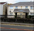
Ordnance Survey Cut Mark
This OS cut mark can be found on the wall of No15 Emlyn Terrace. It marks a point 62.198m above mean sea level.
Image: © Adrian Dust
Taken: 22 Jan 2014
0.07 miles
2
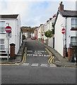
Britannia Road houses, Plasmarl, Swansea
Alongside the ascent from the B4603 Neath Road in the Plasmarl area of Swansea.
Image: © Jaggery
Taken: 12 Nov 2018
0.08 miles
3
Site of the former Hermon Welsh Congregational Chapel, Plasmarl, Swansea
The plaque https://www.geograph.org.uk/photo/5993219 on the wall of a Neath Road house records that Hermon Welsh Congregational Chapel was on this site for 130 years from 1866.
Image: © Jaggery
Taken: 12 Nov 2018
0.09 miles
4
Hermon Welsh Congregational Chapel plaque, Plasmarl, Swansea
The plaque on the wall here https://www.geograph.org.uk/photo/5993218 records that Hermon Welsh Congregational Chapel was on this site for 130 years from 1866.
Image: © Jaggery
Taken: 12 Nov 2018
0.09 miles
5
Site of the former Plasmarl Sunday School, Neath Road, Swansea
A plaque https://www.geograph.org.uk/photo/5993216 on the wall behind the car shows PLAS MARL SUNDAY SCHOOL 1867.
Image: © Jaggery
Taken: 12 Nov 2018
0.10 miles
6
Plas Marl Sunday School 1867 plaque, Neath Road, Swansea
On the wall behind the car here. https://www.geograph.org.uk/photo/5993215
Image: © Jaggery
Taken: 12 Nov 2018
0.10 miles
7
Up Britannia Road, Plasmarl, Swansea
Britannia Road ascends from the B4603 Neath Road in the Plasmarl area of Swansea.
Image: © Jaggery
Taken: 12 Nov 2018
0.10 miles
8
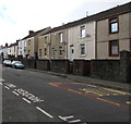
Neath Road houses, Plasmarl, Swansea
Houses set above the B4603 Neath Road, accessed by steps.
Image: © Jaggery
Taken: 12 Nov 2018
0.10 miles
9
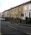
Row of houses above Neath Road, Plasmarl, Swansea
Accessed by steps, the houses are set above the B4603 Neath Road.
Image: © Jaggery
Taken: 12 Nov 2018
0.10 miles
10
Steps and path up from Neath Road, Plasmarl, Swansea
Ascending towards Dinas Street.
Image: © Jaggery
Taken: 12 Nov 2018
0.10 miles


