1
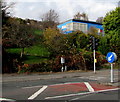
Plasmarl Community Centre, Swansea
In a blue building above the B4603 Neath Road.
Image: © Jaggery
Taken: 12 Nov 2018
0.12 miles
2
Parc Avenue, Swansea
The southwest end of Parc Avenue ascends from the B4603 Neath Road.
Parc is the Welsh form of Park.
Image: © Jaggery
Taken: 12 Nov 2018
0.12 miles
3
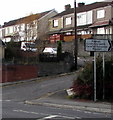
Three houses above Neath Road, Swansea
A detached house and two semi-detached houses viewed across the B4603 Neath Road.
Image: © Jaggery
Taken: 12 Nov 2018
0.12 miles
4
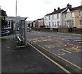
Dinas Street houses, Plasmarl, Swansea
Houses at the northeast end of Dinas Street viewed across the B4603 Neath Road.
Image: © Jaggery
Taken: 12 Nov 2018
0.13 miles
5
Ordnance Survey Cut Mark
This OS cut mark can be found on the wall of No402 Neath Road. It marks a point 29.297m above mean sea level.
Image: © Adrian Dust
Taken: 20 Jan 2014
0.13 miles
6
Warning sign - Humped Pelican Crossing, Neath Road, Swansea
Humped Pelican Crossing is Croesfan Pelican a Thwmpath in Welsh.
Creosfan on the sign is an error.
Image: © Jaggery
Taken: 12 Nov 2018
0.13 miles
7
Metro bus stop and shelter, Neath Road, Swansea
This stop is on Swansea Metro bus route 4 to Morriston Hospital.
Image: © Jaggery
Taken: 12 Nov 2018
0.13 miles
8
Trewyddfa Common, Morriston, Swansea
Houses viewed across the B4603 Neath Road.
The name sign behind the car on the right shows TREWYDDFA COMMON.
Image: © Jaggery
Taken: 12 Nov 2018
0.14 miles
9
Plasmarl Community Centre direction sign, Swansea
The sign facing the B4603 Neath Road points towards this https://www.geograph.org.uk/photo/5988927 blue building.
The text is also in Welsh.
Image: © Jaggery
Taken: 12 Nov 2018
0.15 miles
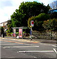
10
Neath Road bus stop and shelter, Plasmarl, Swansea
This stop near Dinas Street is for buses to the city centre and Swansea bus station.
Image: © Jaggery
Taken: 12 Nov 2018
0.16 miles


