1
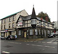
Former Crown pub on a Morriston corner, Swansea
In October 2018 nameboards showing THE CROWN remain on the former pub on the corner of Woodfield Street and Crown Street. Metal sheets protect a door and ground floor windows. A To Let board is on the building.
Image: © Jaggery
Taken: 16 Oct 2018
0.03 miles
2
Old-style name sign, Crown Street, Morriston, Swansea
An enamel street name sign is on the north side of this https://www.geograph.org.uk/photo/5943012 derelict former pub.
Image: © Jaggery
Taken: 16 Oct 2018
0.03 miles
3
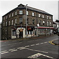
Boarded-up three-storey building, Woodfield Street, Morriston, Swansea
In mid October 2018 a For Sale - Development Opportunity board is on the building.
The former Crown pub on the right is also boarded up. https://www.geograph.org.uk/photo/5943012
Image: © Jaggery
Taken: 16 Oct 2018
0.04 miles
4
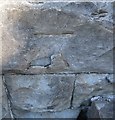
Ordnance Survey Cut Mark
This OS cut mark can be found on the gatepost to the Tabernacle Chapel. It marks a point 32.973m above mean sea level.
Image: © Adrian Dust
Taken: 28 Jan 2014
0.04 miles
5
Capel y Tabernacl 1872 name sign, Morriston, Swansea
The Welsh-only (apart from Secretary) sign is on the left here. https://www.geograph.org.uk/photo/6194311
Image: © Jaggery
Taken: 16 Oct 2018
0.04 miles
6
Sun Lounge Beauty Centre in Morriston, Swansea
At 52 Woodfield Street on the corner of Crown Street.
Image: © Jaggery
Taken: 16 Oct 2018
0.05 miles
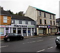
7
Haryana in Morriston, Swansea
Indian cuisine restaurant in Woodfield Street.
Image: © Jaggery
Taken: 16 Oct 2018
0.05 miles
8
Spar, Morriston, Swansea
In a 3-storey building at 53-54 Woodfield Street.
Image: © Jaggery
Taken: 16 Oct 2018
0.05 miles
9
Grade I Listed Capel y Tabernacl, Morriston, Swansea
This large chapel built in 1870-1872 is known as the Cathedral of Welsh Nonconformity. It was originally New Libanus Chapel. The building was Grade I listed in 1993 as perhaps the most ambitious grand chapel in Wales with a striking exterior presence and virtually unaltered interior and fittings.
Image: © Jaggery
Taken: 16 Oct 2018
0.05 miles
10
Ordnance Survey Cut Mark
This OS cut mark can be found on the south face of the Tabernacle Chapel. It marks a point 34.138m above mean sea level.
Image: © Adrian Dust
Taken: 20 Sep 2016
0.05 miles


