IMAGES TAKEN NEAR TO
Rosemary Lane, KILGETTY, SA68 0TA
Introduction
This page details the photographs taken nearby to Rosemary Lane, SA68 0TA by members of the Geograph project.
The Geograph project started in 2005 with the aim of publishing, organising and preserving representative images for every square kilometre of Great Britain, Ireland and the Isle of Man.

There are currently over 7.5m images from over14,400 individuals and you can help contribute to the project by visiting https://www.geograph.org.uk
Image Map
Images are licensed for reuse under creativecommons.org/licenses/by-sa/2.0
Notes
- Clicking on the map will re-center to the selected point.
- The higher the marker number, the further away the image location is from the centre of the postcode.
Image Listing (2 Images Found)
Images are licensed for reuse under creativecommons.org/licenses/by-sa/2.0
Image
Details
Distance
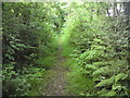
1
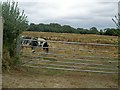
Footpath South from Rosemary Lane
The taller (browning) vegetation running across (behind the top bar of the gate) marks the position of a (now dry) stream.
Image: © Jennifer Luther Thomas
Taken: 11 Aug 2006
0.07 miles