IMAGES TAKEN NEAR TO
Broadmoor, KILGETTY, SA68 0RJ
Introduction
This page details the photographs taken nearby to SA68 0RJ by members of the Geograph project.
The Geograph project started in 2005 with the aim of publishing, organising and preserving representative images for every square kilometre of Great Britain, Ireland and the Isle of Man.

There are currently over 7.5m images from over14,400 individuals and you can help contribute to the project by visiting https://www.geograph.org.uk
Image Map
Images are licensed for reuse under creativecommons.org/licenses/by-sa/2.0
Notes
- Clicking on the map will re-center to the selected point.
- The higher the marker number, the further away the image location is from the centre of the postcode.
Image Listing (13 Images Found)
Images are licensed for reuse under creativecommons.org/licenses/by-sa/2.0
Image
Details
Distance
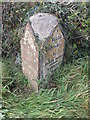
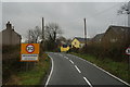
2
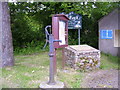
Village Pump and Information Board, Broadmoor
Image: © welshbabe
Taken: 18 Jun 2015
0.14 miles
6
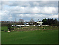
Caravan storage site at Upper Masterland
Taken from the B4586
Image: © Phil Johnstone
Taken: 27 Oct 2008
0.17 miles